Thursday, February 2nd, 2017
By AsiaToday reporter Jina Koh - The “satellite data” war is heating up in Southeast Asia. It’s because they desperately need satellite data to prepare for natural disasters, internet infrastructure construction and more. Read More at Huffington...
Thursday, February 2nd, 2017
Heerbrugg, Switzerland; 2 February 2017 – Leica Geosystems, a global leader of measurement and reality capture technology, today announced it has won both the 2017 PRISM Award for Photonics Innovation and the 2017 Geospatial World Innovation Award....
Thursday, February 2nd, 2017
DENVER, Colorado, USA – TCarta Marine LLC of Denver, Colo., has merged with Proteus Geo of Oxford, UK, to create a global mapping company that provides bathymetric and marine data sets from the shallow coastal zone out...
Thursday, February 2nd, 2017
SAN DIEGO - Building on the strategic alliance between Siemens and Bentley Systems that was made public in November 2016, Siemens’ Energy Management Division and Bentley Systems have announced an agreement to jointly develop solutions to accelerate...

Wednesday, February 1st, 2017
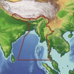
Getech recently released an in-depth report aimed at providing insight into the geology of Myanmar and the surrounding regions. Exploration teams who have access to this report are expected to benefit from understanding the tectonic and geological...
Wednesday, February 1st, 2017
Sydney, Australia – 1 February 2017 – Geospatial data’s enabling role in digital transformation will be on show at the International Symposium on Digital Earth & Locate17 in Sydney in April, combining one of the world’s most...
Wednesday, February 1st, 2017
GeoSLAM Desktop V3 builds on the success of the popular local desktop version of their SLAM processing software that was released at the start of 2016. Whilst maintaining the simplicity and ease of use of the initial...
Wednesday, February 1st, 2017
Getech, providers of natural resources exploration data and information expertise, has released an informative and in-depth report aimed at providing insight into the geology of Myanmar and the surrounding regions. Regional Reports, written by Getech’s expert geologists...
Wednesday, February 1st, 2017
TEL AVIV — Germany has extended a leasing contract to operate the Israeli Heron-1 unmanned aerial system (UAS) for another year in support of ongoing operations in Afghanistan, state-owned Israel Aerospace Industries (IAI) announced Thursday. Read More at...
Wednesday, February 1st, 2017
Rueil-Malmaison, France - SBG Systems releases a new version of the Ellipse Series, its popular product line of miniature inertial sensors. The Ellipse has been greatly improved, showing unmatched performance in attitude measurement while adding Galileo constellation...