Wednesday, March 1st, 2017
ALHAMBRA, Calif. - EMCORE Corporation (NASDAQ:EMKR), a leading provider of advanced Mixed-Signal Optics products that provide the foundation for today’s high-speed communication network infrastructures and leading-edge defense systems, announced today the introduction of the 5200 Series, 3...
Wednesday, March 1st, 2017
OWINGS MILLS, MD ― March 1, 2017 — Rand Worldwide (OTCBB: RWWI), a global leader in providing technology solutions to organizations with engineering design and information technology requirements, today announces that its IMAGINiT Technologies division was awarded...

Tuesday, February 28th, 2017
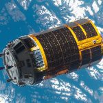
The Japan Aerospace Exploration Agency (JAXA) announced that its H-II Transfer Vehicle KOUNOTORI6 (HTV6), after completion of deorbit maneuver, reentered Earth according to schedule on Feb. 5, 2017. KOUNOTORI6 berthed to the International Space Station (ISS) on...
Tuesday, February 28th, 2017
Friedrichshafen - Sentinel-2B, Europe´s next Copernicus satellite is being readied by engineers from Airbus for a 7 March 2017 lift-off from Kourou, French Guiana. Sentinel-2B will be the fifth satellite of Europe’s environmental monitoring programme Copernicus to...
Tuesday, February 28th, 2017
BARCELONA, Spain - DJI, the world leader in unmanned aerial technology, Sunday unveiled the new Matrice 200 drone series (M200), which is purpose-built for professional users to perform aerial inspections and collect data – making drone technology...
Tuesday, February 28th, 2017
BARCELONA, Spain - Qualcomm Technologies, Inc., a subsidiary of Qualcomm Incorporated (NASDAQ: QCOM), today announced it is working with TomTom (TOM2), a global leader in navigation and mapping products, on using the Qualcomm® Drive Data Platform for high-definition...
Tuesday, February 28th, 2017
Denver, CO – LAND INFO Worldwide Mapping, LLC, a pioneer in advanced imagery and mapping solutions, and GeoNorth Information Systems (GNIS), the only commercial geospatial solution provider to own a US-based, multi-mission Direct Receiving Station (DRS) for...
Tuesday, February 28th, 2017
Airbus Defence and Space has closed a partnership agreement with Bird.i, a global platform for accessing the world’s best satellite, airborne and drone imagery. Objective of the partnership is to allow real-time on-line visualisation of Airbus Defence...
Tuesday, February 28th, 2017
China is set to launch this year its first remote-sensing satellite, the Luojia-1A, which could detect lighted structures on the ground at night. Read More at TeleGiz.com
Tuesday, February 28th, 2017
Behind the scenes of every location search on your favourite hotel websites, property search pages or restaurant finder apps is an algorithm that sorts search results using straight line distances. But when was the last time you...