
Tuesday, April 11th, 2017
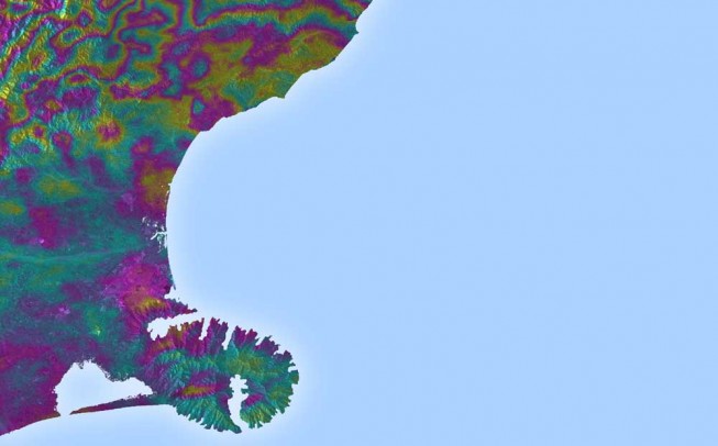
Satellite radar scans of the 7.8-magnitude Nov. 14, 2016, earthquake in New Zealand are changing the way scientists think about earthquake hazards in regions where Earth’s tectonic plates meet. The quake struck near the town of Kaikoura...
Tuesday, April 11th, 2017
Stillwater, Okla.- STILLWATER, OK – APRIL 7, 2017 – DroneDeploy, the leading cloud software platform for commercial drones today announced an integration with agX® to help growers more easily capture field maps and analyze aerial data. agX...
Tuesday, April 11th, 2017
US: Microdrones has announced that leading equipment provider for surveying and construction companies throughout Texas, Martin Instrument, has added a new product line to their extensive offering: Microdrones mdMapper unmanned aerial systems. These complete solutions include everything...
Tuesday, April 11th, 2017
Laser maps collected by airborne mounted sensors have, for the first time, been used to successfully segment individual trees affected by the deadly Larch tree disease. The laser scanning surveys (LiDAR) were undertaken by aerial mapping company...
Tuesday, April 11th, 2017
From 1 April to 30 June 2017, the European Satellite Navigation Competition (ESNC) – the largest international competition for the commercial use of satellite navigation – is once again in search of outstanding ideas and business models....
Tuesday, April 11th, 2017
New Delhi/Kolkata (IBNS): Esri India, country's leading Geographic Information System (GIS) Software & Solutions provider, has launched the third edition of its annual GIS contest mApp Your Way App Development Challenge 3.0. An application (mobile or web)...
Tuesday, April 11th, 2017
The world’s biggest geopolitical trend today is not America First, or the global war on terror, or Brexit, or the renewed Cold War with Russia. It is the economic integration of Europe with Asia, especially the European...
Tuesday, April 11th, 2017
Held every two years, the ISPRS Geospatial Week (ISPRS GSW) is one of the world’s largest and most comprehensive technical conferences focused on photogrammetry, remote sensing and geospatial information. ISPRS GSW 2017 will be held in Wuhan,...
Tuesday, April 11th, 2017
LONDON - The most advanced remote sensing technology which has been seen so far is hyperspectral imaging systems. Recently, scientists have developed new low cost hyperspectral systems for natural gas detection. The innovation has been done by...
Tuesday, April 11th, 2017
SACRAMENTO, Calif.- Aerojet Rocketdyne, Inc., a subsidiary of Aerojet Rocketdyne Holdings, Inc. (NYSE:AJRD), announced plans for the next phase of its Competitive Improvement Program (CIP) that was launched in 2015. The next phase (Phase II) includes additional...