Thursday, May 4th, 2017
Herndon, Virginia — The United States Geospatial Intelligence Foundation (USGIF) recently confirmed new keynote speakers for its GEOINT 2017 Symposium, which will take place June 4-7 at the Henry B. Gonzalez Convention Center in San Antonio, Texas....
Thursday, May 4th, 2017
Washington, D.C. - TerraGo, a pioneer of geospatial collaboration, field data collection and enterprise mobility software, announces the availability of TerraGo Edge version 4.0, offering a completely redesigned app based on customer feedback, field user observations and...
Thursday, May 4th, 2017
Geographic Information Systems (GIS) software developer Cadcorp releases a new application to help fire services determine aggregate risk. Risk Modeller provides analytical functionality for determining risk by combining the effects of spatial and attribute data from a...
Thursday, May 4th, 2017
Huntsville, Alabama – Valtellina SpA, one of the largest communications systems integration companies in Italy, has implemented Hexagon Safety & Infrastructure’s advanced telecommunications GIS software, Intergraph G/Technology Fiber Optic Works, to support the design and implementation of fiber...
Thursday, May 4th, 2017
Today, we are happy to announce our Pix4Dmapper Desktop 3.2 release. The new version has great advancement in stability and usability - Upload desktop projects to cloud is now 10x faster; Camera parameter correlations are displayed in...
Thursday, May 4th, 2017
MCLEAN, Va. - Iridium Communications Inc. (NASDAQ:IRDM), the only communications company with 100 percent global coverage, has announced that the first set of Iridium NEXT satellites have been integrated into the operational constellation and are providing excellent...
Thursday, May 4th, 2017
Norcross, Georgia – Leica Geosystems, a leader in the world of measurement and survey for nearly 200 years, has redefined what’s possible in the imaging laser scanner market with the introduction of the BLK360, the world’s smallest...
Thursday, May 4th, 2017
SACRAMENTO, Calif. - Julie Van Kleeck, vice president of Advanced Space and Launch Programs and Strategy at Aerojet Rocketdyne, a subsidiary of Aerojet Rocketdyne Holdings, Inc. (NYSE:AJRD), has been named an American Institute of Aeronautics and Astronautics...

Tuesday, May 2nd, 2017
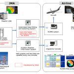
In April 2017, the Airport Low-level Wind Information (ALWIN) system, jointly developed by the Japan Meteorological Agency (JMA) and the Japan Aerospace Exploration Agency (JAXA), started operations at Tokyo International Airport (Haneda) and Narita International Airport. ALWIN...