Monday, July 31st, 2017
WESTMINSTER, Colo. - DigitalGlobe, Inc. (“DigitalGlobe”) (NYSE: DGI), the global leader in Earth imagery and information about our changing planet, today announced its preliminary results that its shareowners overwhelmingly voted to approve the Company’s proposed merger with...
Monday, July 31st, 2017
Huntsville, AL – GeoCue Group Inc. (GeoCue) is excited to announce a new GNSS positioning system that will allow users of DJI Phantom 4 Pros and Inspire 2 drones (as well as most drones using higher end...
Monday, July 31st, 2017
Lake Mary, FL - FARO® (NASDAQ: FARO), the world’s most trusted source for 3D measurement and imaging solutions for factory metrology, construction BIM/CIM, product design, public safety forensics, and 3D solutions, announces the availability of the FARO®...
Monday, July 31st, 2017
The 18th Annual International LiDAR Mapping Forum (ILMF), taking place in Denver, Colorado, USA, February 5-7, 2018, has announced a Call for Papers and invites interested parties to submit their abstracts by August 14, 2017. ILMF is...
Thursday, July 27th, 2017
SUNNYVALE, Calif.—Trimble (NASDAQ: TRMB) introduced today Trimble® Penmap® for Android™, a cloud-connected application for field surveying and high-accuracy Geographic Information System (GIS) data collection that works on mobile handhelds, smartphones and tablets. Trimble Penmap for Android focuses...
Thursday, July 27th, 2017
CORPUS CHRISTI, Texas – The Conrad Blucher Institute for Surveying and Science (CBI) at Texas A&M University-Corpus Christi has officially joined the United Nations-Global Geospatial Information Management (UN-GGIM) Academic Network. Texas A&M-Corpus Christi is one of three...

Tuesday, July 25th, 2017
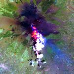
Researchers from the University of Hawaiʻi at Mānoa School of Ocean and Earth Science and Technology (SOEST) recently discovered that infrared satellite data could be used to predict when lava flow-forming eruptions will end. Using NASA satellite...
Tuesday, July 25th, 2017
WILSONVILLE, Ore. – FLIR Systems Inc. (NASDAQ) announced today that VisionLink srl will become FLIR’s first authorized machine vision distributor in Italy and will begin selling FLIR’s lineup of FLIR USB3 Vision and FLIR GigE Vision area...
Tuesday, July 25th, 2017
WILSONVILLE, Ore. – FLIR Systems Inc. (NASDAQ) today released a new Gigabit Ethernet-based (GigE) machine vision camera, the FLIR Blackfly S. Ideal for a range of applications including display and PCB inspection, microscopy, robotics, 3D scanning, intelligent...
Tuesday, July 25th, 2017
TORONTO, Ontario, Canada – The Norwegian Space Centre has announced successful deployment of critical antennas and probes on the NORsat-1 and NORsat-2 microsatellites built by Canada’s Space Flight Laboratory (SFL) and launched on July 14 from Kazakhstan....