Monday, November 27th, 2017
Canberra scientists are taking the lead in Australia's push to join the space race. Last week Canberra's UNSW launched a satellite it developed with defence scientists into space. Read More at Cranberra Times
Monday, November 27th, 2017
DUBAI (WAM) -- More than 60 experts from GCC countries recently discussed wetland monitoring and management plans using advanced technology, including remote sensing. The participants, who included experts from the UAE, work in wetland management and the...
Monday, November 27th, 2017
China continued its recent rapid pace of space launches on Friday with a Long March 2C rocket carrying a classified payload to low Earth orbit. Read More at GB Times
Monday, November 27th, 2017
TURIN, Italy - Topcon Agriculture introduces TAP, the Topcon Agriculture Platform, a cloud-based agricultural ecosystem designed to provide real-time monitoring and data analysis for smart decision making during every phase of the farming cycle. “The platform is...
Monday, November 27th, 2017
BANGKOK - Agriculture has long been the backbone of Thai economy and remains so today. Looking ahead while the country is transforming itself into an advanced economy, the Thai government is modernizing the country's agricultural sector through...

Monday, November 27th, 2017
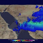
NASA’s Global Precipitation Measurement Mission (GPM) core satellite analyzed severe storms that moved into Jeddah, Saudi Arabia, on Nov. 21, 2017. Heavy downpours caused schools and universities to close, and the General Authority of Meteorology and Environment...
Monday, November 27th, 2017
AUSTIN, Texas - To ensure the most accurate representation of their tank assets and to detect tilt, differential settlement, and deformation, storage tank inspectors and surveyors are now using 3D laser scanning technologies to quickly capture and...
Monday, November 27th, 2017
REDLANDS, Calif.- Esri, the global leader in spatial analytics, today applauded Congress in introducing the Geospatial Data Act (GDA) of 2017 (S. 2128/H.R. 4395). Legislative sponsors Senator Orrin Hatch (R-UT) and Senator Mark Warner (D-VA), U.S. Representative Bruce...
Monday, November 27th, 2017
Hallowell, Maine - Blue Marble Geographics (bluemarblegeo.com) is pleased to announce that the Global Mapper Software Development Kit (SDK) has been expanded to provide data processing capabilities in the cloud. Using Amazon Web Services (AWS), developers can...
Monday, November 27th, 2017
Munich: European Space Imaging is proud to announce its 15th year as the leading premium supplier of satellite imagery to the remote sensing industry, offering the highest spatial resolution currently commercially available. Estimated Article Reading Time: 1...