Tuesday, January 9th, 2018
India: The Indian Railways has decided to deploy drones for project monitoring. The UAVs will be used to monitor railway projects, tracks maintenance, help in crowd management and oversee maintenance work across different zones, railway officials said...
Tuesday, January 9th, 2018
PLANO, Texas- Fortress UAV, a North American supplier of repair, support and after-market services for the drone market, announced today that it has expanded repair and replacement support for many popular drone models including the DJI Mavic,...
Tuesday, January 9th, 2018
LAS VEGAS - TomTom (TOM2), today announced the launch of TomTom AutoStream, an innovative map delivery service for autonomous driving and advanced driver assistance systems. Announced today at CES, are the first partners to use the technology:...
Tuesday, January 9th, 2018
CES, Las Vegas - TomTom (TOM2) and Baidu, Inc. (NASDAQ: BIDU) today announced an extension to their collaboration on high definition (HD) maps for autonomous driving. TomTom's HD Map and TomTom AutoStream, which was announced today at...
Tuesday, January 9th, 2018
PITTSBURGH, PA— Side-scanning technology is used to image the interior of sewer pipes without relying on video. A side-scan captures the entirety of a pipe wall as a single high-res image, allowing engineers to quickly evaluate condition...

Monday, January 8th, 2018
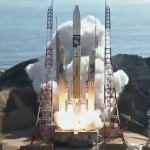
On Dec. 23, 2017, two research satellites to probe Earth’s climate patterns and test ion engine technology to counter atmospheric drag in an unusual low-altitude orbit launched from the Tanegashima Space Center on top of a Japanese...
Monday, January 8th, 2018
LAS VEGAS, NEVADA - Innoviz Technologies, a leading provider of LiDAR sensing solutions, announced today the commercial launch of InnovizPro™, a stand-alone, solid-state, MEMS-based scanning LiDAR solution offering the most accurate and reliable performance of any LiDAR...
Monday, January 8th, 2018
A high-altitude pseudo-satellite (HAPS) is a category of unmanned aircraft that AeroVironment Inc. thinks could deliver a multitude of benefits to the commercial market through use of Internet of Things (IoT) and other technologies and concepts. Read...
Monday, January 8th, 2018
An earth observation satellite jointly developed by China and Brazil is scheduled to be launched into space in 2019, according to China Aerospace Science and Technology Corporation. Read More at Xinhua
Monday, January 8th, 2018
North and South Korea this morning agreed to hold their first meeting in two years - after Seoul and Washington decided to put joint military exercises on ice. Read More at The Sun