Thursday, May 17th, 2018
Teledyne Optech will display its newest airborne lidar solutions for acquiring accurate geospatial data at GEO Business 2018, London, UK, on May 22-23, 2018. Visitors to booth L28 can discover the wide area mapping features of the...

Tuesday, May 15th, 2018
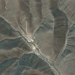
An underground test of what was claimed by North Korea to be a hydrogen bomb shook the surrounding landscape so violently that it changed the shape of an entire mountain. Radar analysis of the area revealed changes...
Tuesday, May 15th, 2018
Montreal, Canada, May 15th, 2018 – SimActive Inc., a world-leading developer of photogrammetry software, is proud to announce an improved workflow for DJI users. Hours of processing time per project are now saved, with volume measurement, pre-construction...
Tuesday, May 15th, 2018
U.S. Transportation Secretary Elaine Chao officially announced the first 10 participants in the agency's Unmanned Aircraft Systems (UAS) Integration Pilot Program at a May 9 event in Washington D.C.; a three-year test program led by the Federal Aviation...
Tuesday, May 15th, 2018
NEWTON MA (USA) - The Applied Geography Conferences (AGC) annual conference will be held October 31 through November 2, 2018, at Kent State University Hotel and Conference Center (Kent, Ohio). AGC exists to promote the application of...
Monday, May 14th, 2018
The Chinese Academy of Sciences confirmed that one of its institutes has successfully tracked and received the data from the recently launched Gaofen-5, a the hyperspectral imaging satellite. Read More at Xinhuanet
Monday, May 14th, 2018
India’s premier space agency Indian Space Research Organisation (ISRO) has built a reputation for building homegrown Indian space technologies in a most cost-effective way, so much so that India’s Mars Orbiter Mission craft Mangalyaan costed less than...
Monday, May 14th, 2018
Almost 30 years’ worth of Landsat observations created a comprehensive inventory of catastrophic floods caused by glacial lakes bursting through their rock dams. Read More at EOS
Monday, May 14th, 2018
The Supreme Court on Thursday asked the Delhi government if it could use the funds collected from the Environment Compensation Charge (ECC) to purchase remote-sensing machines to detect pollution emitted from diesel vehicles plying on the roads....
Monday, May 14th, 2018
The Australian government has announced inaugural seed funding of AUS$26 million over four years to establish an Australian Space Agency, as part of a larger AUS$41 million investment in space-related funding. Read More at SpaceWatch