
Tuesday, June 12th, 2018
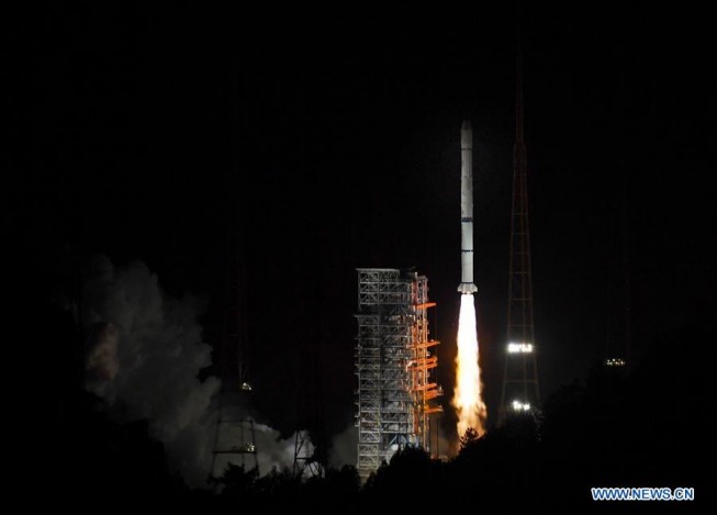
On June 5, 2018, China launched Fengyun-2H, a meteorological satellite that will be placed in a geosynchronous orbit. The launch took place using the three-stage rocket Long March 3A from Xichang Satellite Launch Centre in Sichuan Province....
Tuesday, June 12th, 2018
NORCROSS, GA. – Hexagon’s Geospatial Division, a world leader in high performance geospatial solutions, is excited to announce full details of its Luciad V2018 release at HxGN LIVE 2018, taking place in Las Vegas, from June 12th...
Tuesday, June 12th, 2018
OR YEHUDA, Israel: ImageSat International N.V. ("ISI"), a global leader in end-to-end geospatial solutions, together with MAGNUS International Search & Rescue announces a new service - EMERGENCY AND DISASTER MANAGEMENT. The new service enables countries, cities and...
Tuesday, June 12th, 2018
SEATTLE - Spaceflight, the leading satellite rideshare and mission management provider, announced today it has partnered with Rocket Lab for three upcoming launches. The first Electron mission, scheduled for the end of 2018, will launch a BlackSky...
Tuesday, June 12th, 2018
SUNNYVALE, Calif. - Trimble (NASDAQ: TRMB) announced today the launch of Trimble® Basis, a software application designed to make it easier for corporate real estate teams to see how office workspace is being used. Trimble Basis enables organizations...
Tuesday, June 12th, 2018
Montreal, Canada, June 12th, 2018 – SimActive Inc., a world-leading developer of photogrammetry software, is proud to announce use of its software for precision agriculture in Brazil by Portal Produtos Agropecuários Ltda (Portal). Drone data is transformed...
Tuesday, June 12th, 2018
Hexagon, a global leader in digital solutions, opens HxGN LIVE 2018 today, its annual, four-day, international digital solutions conference. Held 12-15 June at The Venetian hotel in Las Vegas, NV, USA, HxGN LIVE brings together thousands of...
Monday, June 11th, 2018
LIVERMORE, Calif., U.S./ CAPELLE A/D IJSSEL, the Netherlands – Topcon Positioning Group introduces the new T-18 handheld controller designed to drive geopositioning, construction, mapping and vertical construction applications. The controller includes a 3.7-inch sunlight-readable display with a 1GHz...
Monday, June 11th, 2018
Leicestershire, UK – Bluesky has revealed plans to update over 160,000 square kilometres of aerial photography, colour infrared imagery and digital height models in 2018. When combined this equates to a total of 640,000 square kilometres of...
Monday, June 11th, 2018
Hollywood International Ltd., the largest local consulting firm of Surveying and Mapping in Thailand, is also the best business partner of Supergeo. Recently, Hollywood has successfully promoted SuperSurv in a local private pipeline company. The company has...