Wednesday, October 6th, 2021
REDLANDS, Calif.- Global construction challenges, from affordable housing availability to infrastructure stress as a result of climate change, have increased in recent years. As a result, governments and commercial organizations will need to invest trillions of dollars...
Wednesday, October 6th, 2021
SAN JOSE, Calif.- Cepton Technologies (“Cepton”), an innovative provider of smart lidar solutions, and Vortex IoT (“Vortex”), a UK-based IoT solutions company, have combined their skills to turn UK buses into real-time road inspection tools, enabling a lidar-based vehicle to infrastructure...
Wednesday, October 6th, 2021
WESTMINSTER, Colo.- Maxar Technologies (NYSE:MAXR) (TSX:MAXR), a trusted partner and innovator in Earth Intelligence and Space Infrastructure, today announced it has been awarded an Option Year 2 contract renewal by the U.S. National Geospatial-Intelligence Agency (NGA) for...
Wednesday, October 6th, 2021
WASHINGTON -- Riverside Research will officially introduce its Commercial Innovation Center (CIC) to a wide audience of Government officials, commercial data providers, and application developers at the 2021 USGIF GEOINT Symposium in St Louis, Missouri, Oct. 5-8. The CIC is a first-of-its-kind...
Wednesday, October 6th, 2021
NEW YORK - Dark Pulse, Inc. (OTC Markets: DPLS) (“DarkPulse” and the “Company”), a technology company focused on the manufacture, sale, installation, and monitoring of laser sensing systems based on its patented BOTDA dark-pulse sensor technology (the...
Wednesday, October 6th, 2021
BURLINGTON, Mass.-Precisely, the global leader in data integrity, today announced the launch of MapInfo Pro v2021 – the newest release of its popular Geographic Information System (GIS) product. MapInfo Pro v2021 enables customers to add location-based context...
Wednesday, October 6th, 2021
AUSTIN, TEXAS - Optelos, Imagine Technologies and Cotney have come to together to bring the latest roofing inspection technology to the commercial roofing industry, enabling commercial roofing contractors, property managers and material manufacturers to more rapidly and...

Tuesday, October 5th, 2021
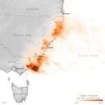
Australia is no stranger to bushfires, but the 2019-2020 season proved to be unprecedented. In southeast Australia, the fires were both intense and extensive. As much as 74,000 square kilometers of mostly eucalyptus forest, roughly 2.5 times...
Tuesday, October 5th, 2021
Premiering new visual verification features for Autodesk Build and BIM 360 Upper Saddle River, New Jersey, Oct 5, 2021 – EarthCam, the leader in webcam technology and services, released important upgrades to its Autodesk Construction Cloud®...
Tuesday, October 5th, 2021
Former Orbital Insight Vice President joins geospatial intelligence leader to expand company’s presence across US Government entities - Edgybees, the leading visual intelligence technology company, announced today the appointment of Craig Brower...