Wednesday, August 9th, 2017
REDLANDS, Calif. - Esri, the global leader in spatial analytics, announced today that Smart Dubai, the government agency leading Dubai's smart city transformation, has signed an enterprise agreement (EA) providing ArcGIS technology to 44 entities across the...
Wednesday, August 9th, 2017
SANTA MONICA, Calif. - Today, AirMap and Kansas Department of Transportation (KDOT) are announcing that they will deploy Unmanned Traffic Management (UTM) technology across the state of Kansas. The initiative, which is the first of its kind in the United States, will support the growth of...
Wednesday, August 9th, 2017
TerraGo is pleased to announce a partnership with Laser Technology, Inc. (LTI) that will enable all custom apps built by TerraGo Magic to seamlessly utilize LTI’s professional grade laser rangefinders. TerraGo Magic partners and customers can now...

Tuesday, August 8th, 2017
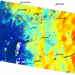
The Indian Space Research Organisation (ISRO) used the SCATSAT-1 satellite to track flooding across India during the 2017 monsoon season, with a special focus on Gujarat and Rajasthan. Monsoon activity in West Bengal, Uttar Pradesh, Assam and...
Tuesday, August 8th, 2017
Herndon, VA – August 8, 2017 – Skyline Software Systems Inc. announced today that it has released PhotoMesh v7.2. This latest version of the software offers new performance features including the use of Full Motion Video files...
Tuesday, August 8th, 2017
PETAH TIKVA, Israel - Gilat Satellite Networks Ltd. (NASDAQ:GILT) (TASE:GILT), a worldwide leader in satellite networking technology, solutions and services, announced today that it received orders of USD 11.4 Million, net of local taxes, to provide state-of-the-art...
Tuesday, August 8th, 2017
Astun Technology, the leading provider of cloud-based open-source GIS solutions to local and central governments has announced its latest schedule of training courses which have all been specifically designed to ensure attendees return to their everyday workflows...
Tuesday, August 8th, 2017
Herndon, VA – Skyline Software Systems Inc. announces the release of the all-new SkylineGlobe Server 7, a private cloud solution that provides a comprehensive set of web services for publishing, storing, managing and streaming 3D spatial data....
Tuesday, August 8th, 2017
The 18th Annual International LiDAR Mapping Forum (ILMF), taking place in Denver, Colorado, USA, February 5-7, 2018, has announced a Call for Papers and invites interested parties to submit their abstracts by August 14, 2017. ILMF is...
Tuesday, August 8th, 2017
Alexandria, VA - The geospatial intelligence community workforce is growing at an ever-increasing rate. The value of the work being performed by the GEOINT community is developing parallel to the workforce itself. Efforts of lead GEOINT agencies,...