Wednesday, September 19th, 2018
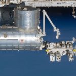
The United Nations Office for Outer Space Affairs (UNOOSA) and the Japan Aerospace Exploration Agency (JAXA) have selected a team from Surya University in Indonesia for the UNOOSA-JAXA KiboCUBE programme. The KiboCUBE programme was launched in 2015...
Wednesday, September 19th, 2018
WASHINGTON - The U.S. Army Corps of Engineers (USACE) announced today the publishing of the online Trafficability Inundation Mapping Tool that provides the public with information on what regions are affected by the flood waters from Hurricane...

Tuesday, September 18th, 2018
The Japan Aerospace Exploration Agency (JAXA) and the United Nations Office for Outer Space Affairs (UNOOSA) have been cooperating under the KiboCUBE program launched in 2015 to provide opportunities to deploy CubeSats from the Japanese Experiment Module...
Tuesday, September 18th, 2018
Montreal, Canada, September 18th, 2018 – SimActive Inc., a world-leading developer of photogrammetry software, is proud to announce it enabled the first government drone mapping project in South Korea. Asia Aero Survey (AAS), a SimActive regional partner,...
Tuesday, September 18th, 2018
Nanotron Technologies GmbH has achieved and deployed a new release of its nanoLES 3 Location Engine and Server software. Through nanoLES 3 5K, nanotron is now able to accurately and reliably track up to 5,000 distinct objects...
Tuesday, September 18th, 2018
Quantum Spatial, Inc. (QSI), the nation’s largest independent geospatial data firm, today announced that QSI won Zpryme’s start@ETS pilot pitch competition for having the most compelling, innovative solution for energy and utility companies. Hosted by Zpryme, a research agency...
Tuesday, September 18th, 2018
Bologna, Italy - SITECO Infomatica SRL , developer of the highly flexible Road-Scanner and Pave-Scanner product family, has released their latest version of Road-SIT Survey software suite which now includes complete data format compatibility with TopoDOT software...
Tuesday, September 18th, 2018
Surrey Satellite Technology Ltd (SSTL) has confirmed the successful launch of two satellites, NovaSAR-1, a Synthetic Aperture Radar (SAR) satellite, and SSTL S1-4, a high resolution optical Earth Observation satellite. The two satellites were launched into a...
Tuesday, September 18th, 2018
Galileo and BeiDou observation data are now included with Trimble VRS Now subscriptions in North America. The addition of the Galileo and BeiDou constellations allow users to make use of more satellites, enabling more robust performance when...
Monday, September 17th, 2018
ARLINGTON, Va. (AFNS) -- The U.S. Air Force announced selection of Lockheed Martin for a fixed-price-type production contract for 22 GPS III Follow-On satellites with a total estimated contract value up to $7.2 billion. “The world is...