Thursday, October 27th, 2011
SuperGeo announces that SuperGIS Mobile Tour 3, the mobile GIS application designed for tourism, has been updated and enhanced. SuperGIS Mobile Tour 3 is the application especially for tour navigation, enabling administrators to develop a system integrating GPS...
Thursday, October 27th, 2011
SuperGeo announced that the branch company of Aurecon Company in South Africa has purchased SuperGIS Desktop 3 for their GIS/Data Management Department, which is planning to cooperate with SuperGeo’s South Africa distributor, Spatial Perspective for the purpose...
Monday, October 24th, 2011
This map presents the standing flood waters over Nakhon Nayok,Thailand based on analysis of satellite data recorded 16 October 2011. A preliminary analysis show extensive flooding over the provinces of Nakhon Nayok, Pathon Thani, Bangkok, Phra Nakhon...
Monday, October 24th, 2011
The wreck of a ship believed to have been part of the ill-fated attempts by Kublai Khan, the Mongolian ruler of China in the 13th century, to invade Japan has been found lying relatively intact under the...
Monday, October 24th, 2011
The NSW Minerals Council has called on the Government to strike a balance in strategic land use planning and to provide certainty. Speaking at the Environment and Community Conference today in Wollongong, NSWMC CEO Nikki Williams stated that "the...
Monday, October 24th, 2011
For better management and planning of coastal areas and their resources, Gujarat government is implementing a Geo-Spatial Information System (GIS) development project. "The development of GIS for coastal areas is a key component of Integrated Coastal Zone...
Monday, October 24th, 2011
Korea Forest Service (KFS) specializes in planting and taking care of forests. It aims to build a sustainable green welfare nation with a mission to promote healthy forests, rich mountains, and a happy populace. To satisfy this...

Friday, October 21st, 2011
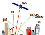
The Quasi-Zenith Satellite System (QZSS) is a constellation of multiple satellites, with at least one satellite positioned near zenith over Japan at anytime. The purpose of the system is to enable improved satellite coverage, thereby enhancing the...

Thursday, October 20th, 2011
The term Smart Grid conjures up many impressions. To the Mitsubishi company it means innovation and revolution within Japanese households. The company expects to generate over a trillion yen within 5 years through products integrated to transform...