Asian Surveying & Mapping
Breaking News
Australian Space Agency funds development of aerospace-grade GNSS receiver
The Australian Space Agency has funded the development of...
Continuity risks for Australian EO data access
A new report details the widespread use of Earth...
China launches new remote sensing satellite
JIUQUAN, April 15 (Xinhua) -- China on Monday launched...
7.4-Magnitude Earthquake Strikes Taiwan
A major, 7.4-magnitude earthquake struck the eastern coast of...
Tata Deploys Its Geospatial Satellite In Space on Space X’s Falcon 9 Rocket
THIRUVANANTHAPURAM: Tata Company launched India's first private commercial satellite...
Taiwan’s Formosat-8 Satellite Set for Launch by 2025
The Taiwan Space Agency has announced progress on the...
Iranian Scientists to Build Satellite Constellation for 2 Simultaneous Missions
The scientists at the knowledge-based company had previously succeeded...
China provides geospatial intel and other military support to Russia, US says
The US has warned its European allies that China...
Japanese lunar lander company ispace raises $53.5 million in stock sale
WASHINGTON — Japanese lunar lander developer has raised $53.5...
Esri and Prince Sultan University Advance GIS Education Through Strategic Partnership
Memorandum of Understanding with Institution Enhances GIS Curriculum and...

Author Archive

image

Friday, January 21st, 2011

Russian Satellites Monitoring Weather

Changing climate is heightening the need for improved information related to weather. Traditionally, Russia has not many such satellites operating in space and therefore has not had the capability to provide up-to-date weather forecasting. But that picture...

Friday, January 21st, 2011

ASM Newsletter – January 21, 2011

If you have trouble viewing this newsletter, click here to view in a browser      ASM Website Calendar Submit Editorial   The Geospatial World Forum Showcases the Rise of India's Geospatial Sector The Geospatial World Forum...

Thursday, January 13th, 2011

Flood Inundation Mapping- An Application of Remote Sensing Techniques

This paper describes two applications of remote sensing on a near-real time mapping of flood inundation and crop health in the light of natural disaster and crop monitoring. The mapping of flood inundation was carried out over...

Thursday, January 13th, 2011

Russia to Launch Ocean Satellite in March

Russia will launch an oceanography satellite in March to keep track of a vast amount of data that will help improve weather, climate and ocean forecasts, a Russian scientist said on Wednesday. "It will be a kind...

Monday, January 10th, 2011

Trimble Announces Availability of ThingMagic Mercury6e RFID Reader Module

Achieving several market firsts, the M6e is the world's smallest 1 Watt, four port UHF reader module on the market today, delivering leading performance and significant time-to-market advantages to original equipment manufacturers (OEM), value added resellers (VAR),...

Wednesday, January 5th, 2011

Developing Spatial Statistics

The Spatial Industries Business Association (SIBA) has recently published a paper entitled 'Setting up a Spatial Industry Statistics Program —A Discussion Paper'.  As the Discussion Paper points out, there is currently no means for collecting spatial statistics...
Saturday, January 1st, 2011

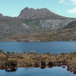
Australian Parks

Welcome! This is a basic site about the beautiful and fascinating parks of Australia. On this site you can read all about my travels to different parks, see photos, and find links to park websites. This sample...

Saturday, January 1st, 2011

Banner Module

The banner module is used to display the banners that are managed by the banners component in the site administrator. Help. {loadmodule banners,Banners}

Page 12 of 28 1 7 8 9 10 11 12 13 14 15 16 17 28