Asian Surveying & Mapping
Breaking News
HAL to build, market Isro’s SSLV in landmark deal
New Delhi, Jun 20: In a historic move for...
Taiwan developing space capabilities for all-weather imaging
TAIPEI (TVBS News) — Taiwan is advancing its space...
Honda hails successful test of reusable rocket as it looks to get into the space business
Tokyo — Japan's second-biggest carmaker, Honda, has successfully tested...
China’s space program provides larger platform for broader international cooperation
BEIJING -- Experts from China's manned space program said...
India To Launch $1.5 Billion Joint Earth Mission With NASA In July
National Aeronautics and Space Administration (NASA) and the Indian...
Axiom-4 mission delayed again: ISRO confirms Subhanshu Shukla’s ISS spaceflight won’t launch before 22 June 2025
The Axiom-4 mission to the International Space Station has...
Mengzhou spacecraft for China’s moon-landing mission passes landmark test flight
China has completed the inaugural test flight of its...
Space application for ITMA Asia + CITME 2026 opens
Shanghai – Space application for the 2026 edition of...
Yanmar, Chia Tai and XAG Empower Thai Agriculture through Innovation
Bang Nam Priao District, Chachoengsao Province, Thailand – On...
bitsensing Signs MOU with IKIO Technologies to Advance AI-Based Traffic Monitoring on India’s Expressways, Highways and Municipal Areas
Backed by proven success in South Korea and Europe,...

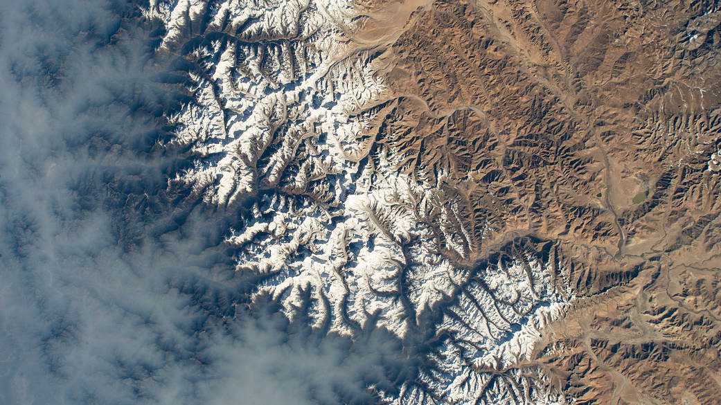
Clouds gather over Nepal near Mount Everest (center) in this April 13, 2023, photograph from the International Space Station. This image was taken as the station orbited 263 miles above the Indian subcontinent. 

In addition to photography, instruments on the space station like the Compact Ocean Wind Vector Radiometer and the Temporal Experiment for Storms and Tropical Systems allow us to monitor weather and collect important data. 

Image Credit: NASA