Leica Geosystems, a Hexagon company, announced today a new 3D laser scanning bundle for the BLK360 and greater integration with Autodesk ecosystem.
HEERBRUGG, Switzerland – Leica Geosystems, a Hexagon company, announced today a new 3D laser scanning bundle for the Leica BLK360 and greater integration with Autodesk ecosystem.
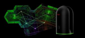
This new bundle consists of the Leica BLK360 imaging laser scanner, Leica Cyclone REGISTER 360 (BLK Edition) desktop software, and Leica Cyclone FIELD 360 for tablets and phones. Customers can get started straight out of the box with seamless connectivity and workflows from Leica Geosystems Reality Capture products to Autodesk’s Reality Computing and design solutions. With this bundle, Leica Geosystems will deliver point cloud production while Autodesk’s technology will consume the data.
“We have been on a path with Autodesk to democratise the reality capture landscape through a blend of software and sensor technology,” said Faheem Khan, Leica Geosystems Vice President of Survey Solutions. “This new bundle provides an improved and seamless capture-consumption workflow for our customers with direct connectivity into the Autodesk ecosystem.”
Preparing reality capture data in one streamlined workflow
With the new Leica Geosystems 3D laser scanning bundle, users can rely on a purpose-built workflow for preparing data from capture to registration and delivery. The new, streamlined workflow supports scan control, optional pre-registration, and GeoTagging in the field. It includes an automated and scalable registration and QA workflow that fully integrates with other Leica Geosystems reality capture solutions, such as Leica CloudWorx plug-ins for Autodesk products. Leica Geosystems continues to invest heavily in the CloudWorx family of plugins, enabling users to speed up or even use smart automation for common 3D laser scanning workflows.
“For years Leica Geosystems and Autodesk have shared a common vision to provide industry professionals with a near-seamless data experience, which we continue to build upon,” said Bryan Otey, director of Autodesk Reality Solutions. “The Autodesk technology ecosystem offers project teams the ability to use information more efficiently from design through construction. From data capture to consumption, this is an important relationship for our customers.”
Leica Geosystems – when it has to be right
With more than 200 years of history, Leica Geosystems, a Hexagon company, is the trusted supplier of premium sensors, software and services. Delivering value every day to professionals in surveying, construction, infrastructure, mining, mapping and other geospatial content-dependent industries, Leica Geosystems leads the industry with innovative solutions to empower our autonomous future.
Hexagon is a global leader in sensor, software and autonomous solutions. We are putting data to work to boost efficiency, productivity, and quality across industrial, manufacturing, infrastructure, safety, and mobility applications.
Our technologies are shaping urban and production ecosystems to become increasingly connected and autonomous — ensuring a scalable, sustainable future.
Hexagon (Nasdaq Stockholm: HEXA B) has approximately 21,000 employees in 50 countries and net sales of 3.9bn EUR. Learn more at hexagon.com and follow us @HexagonAB
