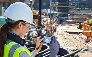
Paris, France – Leica Geosystems part of Hexagon, announced today that its 3D image measurement solution, the Leica BLK3D, has won the 2019 Mondial du Bâtiment Innovation Competition.

The Leica BLK3D has won the 2019 Mondial du Bâtiment Innovation Competition for its unique means of capturing and documenting reality
Selected by a jury of industry professionals, the BLK3D was praised for its innovative and unique way of capturing and documenting reality. The BLK3D was selected from 79 applications and a shortlist of 32 nominees.
“Each win for the BLK3D is a testament to the careful research and development we undertook to design such an advanced technology,” said Burkhard Boeckem, CTO for Hexagon’s Geosystems division. “To be honoured with the Batiment award, in a construction-focused space, is a great achievement in bringing more digital solutions to this industry.”
This is the third time Leica Geosystems has been presented the award, winning with the Leica BLK360 imaging laser scanner in 2017 and with the Leica DISTO™ distance laser metre in 1993. The BLK3D has won other prestigious design and innovation awards, including the CES 2019 Best of Innovation Honouree Award, BAKA 2019 Product Innovation Award, 2019 Prism Award, 2019 iF Design Award, 2019 RedDot Design Award, 2019 German Innovation Award, 2018 Good Design Awards and 2018 Wichmann Innovation Award.
Take a picture. Measure anything.
The BLK3D handheld imager improves productivity by enabling immediate and precise 3D measurements from any image it captures. By combining measurement sensors, software, and on-device edge data processing capabilities, the BLK3D enables in-picture measurements with professional-grade accuracy. Every image captured by the BLK3D is a complete and precise 3D record. Its edge processing capabilities eliminate the need for network connections and/or cloud services, ensuring professionals can make faster decisions within their daily workflow – whether creating floor plans and estimating building installations or documenting construction progress and creating as-built facility documentation.
Leica Geosystems – when it has to be right
Revolutionising the world of measurement and survey for 200 years, Leica Geosystems, part of Hexagon, creates complete solutions for professionals across the planet. Known for premium products and innovative solution development, professionals in a diverse mix of industries, such as aerospace and defence, safety and security, construction, and manufacturing, trust Leica Geosystems for all their geospatial needs. With precise and accurate instruments, sophisticated software, and trusted services, Leica Geosystems delivers value every day to those shaping the future of our world.
Hexagon is a global leader in sensor, software and autonomous solutions. We are putting data to work to boost efficiency, productivity, and quality across industrial, manufacturing, infrastructure, safety, and mobility applications.
Our technologies are shaping urban and production ecosystems to become increasingly connected and autonomous — ensuring a scalable, sustainable future.
Hexagon (Nasdaq Stockholm: HEXA B) has approximately 20,000 employees in 50 countries and net sales of approximately 3.8bn EUR. Learn more at hexagon.com and follow us @HexagonAB.
Hexagon is a global leader in digital solutions that create Autonomous Connected Ecosystems (ACE). Hexagon (Nasdaq Stockholm: HEXA B) has approximately 20,000 employees in 50 countries and net sales of approximately 3.8bn EUR.