STUTTGART, Germany, Sept. 17, 2019—Trimble (NASDAQ: TRMB) announced today an update to its core real-time monitoring software—Trimble® 4D Control. Building on the recently released version 5.0, this update delivers support for Senceive’s wireless monitoring systems, streamlining the configuration process for users and delivering real-time data from geotechnical sensors to one common platform. By receiving data through Senceive’s wireless gateways into Trimble 4D Control software, project stakeholders can quickly and easily monitor critical infrastructure such as buildings surrounding construction sites, rail and tunnel projects as well as mines, dams and bridges.
The announcement was made today at INTERGEO 2019, the world’s largest conference on geodesy, geoinformatics and land management.
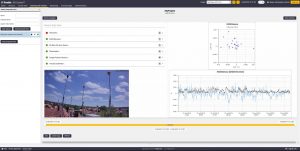
Robust and powerful, Trimble 4D Control software provides unparalleled movement analysis as well as extensive support for a wide variety of monitoring sensors—from total stations to piezometers and crack gauges to GNSS reference receivers. In addition, multiple monitoring sites can be managed from a single, customizable platform that enables visualization, performs rigorous analysis and provides alerts, which are essential for real-time automated monitoring applications.
“The recent release of version 5.0 focused on simplifying workflows and reducing the time needed to set up a monitoring project,” said Lisa Wetherbee, business area director for Trimble Monitoring Solutions. “The integration with Senceive builds on our commitment to continuously enhance the user experience when using Trimble 4D Control. By adding support for more wireless monitoring systems, we are making it easier to access real-time data from a wide variety of geotechnical sensors available for monitoring projects around the world.”
Availability
The updated Trimble 4D Control version is available now through Trimble’s Distribution Channel. To learn more, visit: https://www.trimble.com/Monitoring-Solutions/Trimble-4D-Control.aspx.
About Trimble Monitoring Solutions
Trimble’s portfolio of advanced sensor solutions, application software and state-of-the-art recorders provide proven integrated tools for monitoring earth systems applications. The solutions allow organizations to monitor the integrity of a building, dam, mine, bridge and other structures and natural hazards, monitoring the seismic activity of a project and surrounding communities. Trimble’s customizable and scalable monitoring solutions harness the power of GNSS, optical, seismic, engineering and geotechnical sensors to provide in-depth measurement, data analysis and management tools to help organizations meet a range of project requirements from periodic deformation measurements to real-time automated monitoring solutions. For more information about Trimble Monitoring Solutions, visit: www.trimble.com/monitoring.
About Trimble
Trimble is transforming the way the world works by delivering products and services that connect the physical and digital worlds. Core technologies in positioning, modeling, connectivity and data analytics enable customers to improve productivity, quality, safety and sustainability. From purpose-built products to enterprise lifecycle solutions, Trimble software, hardware and services are transforming industries such as agriculture, construction, geospatial and transportation and logistics. For more information about Trimble (NASDAQ:TRMB), visit: www.trimble.com.
About Senceive Ltd.
Founded in 2005 and based in the United Kingdom, Senceive Ltd. provides an innovative approach to providing reliable, long-life, precise wireless monitoring solutions for buildings, earthworks, rail, bridges, walls, tunnels, structures, dams and mines. By uniquely providing two complementary wireless platforms, Intelligent Mesh (FlatMesh®) and Long-range point-to-point (GeoWAN®), Senceive enables intelligent low-power sensor nodes, including those from different manufacturers, to wirelessly communicate through radio networks. The company’s award-winning and innovative wireless solutions are unrivalled with 12 to 15-year battery life, are practical, robust and easy to deploy, enabling global civil engineering clients to make better short and long-term decisions about their assets. Senceive operates in over 40 countries globally. For more information, visit: http://senceive.com.
