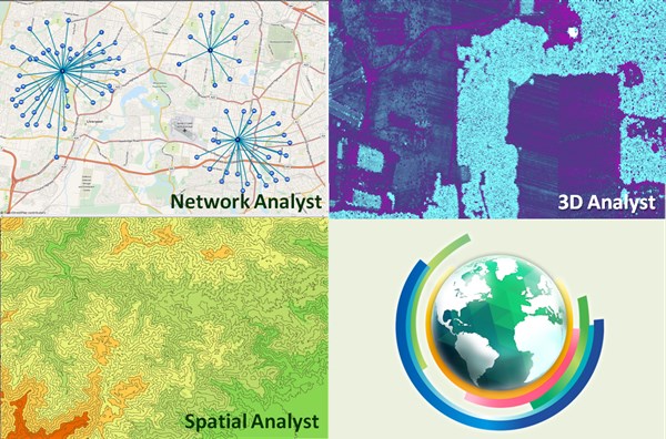
The updated version of SuperGIS Desktop was just released this month. In this update, Supergeo not only improved the performance of SuperGIS Desktop 10 but also released multiple latest SuperGIS Desktop extensions, including Spatial Analyst, Network Analyst, and 3D Analyst, to meet the needs of advanced GIS users.
Spatial Analyst is the extension helps users to integrate raster and vector data for analyzing complex spatial relationships. In this latest version, Spatial Analyst is augmented with several new zonal statistics such as Tabulate Area and Zonal Histogram, assisting users to understand the pattern of the particular phenomenon. For example, users can examine whether the land use classification is reasonable by reviewing the distribution of the certain land use type and the slope.
By using 3D Analyst, users can display data with latest 3D technology, exceeding the limit of traditional 2D maps. Viewing the world in 3D will help you explore the world more comprehensively and hence make better decisions. The new 3D Analyst has added SuperGIS Cube to help users visualize data in the 3D environment. Based on planar projection, SuperGIS Cube is very different from SuperGIS Globe, which the spatial extent is focused on the map layer you have added, and it is more appropriate to present data within a small region.
By analyzing network data, Network Analyst is the extension to help users find the most suitable route to your destination or the best site for your facility. The new Network Analyst has not only significantly improved the performance but also added a new function called O-D Matrix. Through the matrix, users can find the minimum cost routes for multiple origins to multiple destinations with ease. It is a practical feature for many domains. For example, transportation administration can review whether the current distribution of bus stops is reasonable by using every household as origins and bus stops as destinations. After calculation, users are able to find the distances between them and examine whether they are too long.
Helping people to benefit from the analyzing and planning capabilities of GIS and driving the world with GIS are the missions of Supergeo. In the future, Supergeo will continuously develop more practical features to SuperGIS products for serving more users from different industries. To get more news from Supergeo instantly, please follow the Facebook fanpage and twitter account of Supergeo.
To find more information about Spatial Analyst:
http://www.supergeotek.com/products_desktop_SA.aspx
3D Analyst:
http://www.supergeotek.com/products_desktop_3D.aspx
Network Analyst:
http://www.supergeotek.com/products_desktop_NA.aspx