For industries such as asset management, real estate and insurance underwriting, the location information of assets (e.g. buildings, infrastructure facilities, and agricultural land) is among the most important. Through deep research and development, BigData Earth creates new generation property location metrics and insights by integrating various thematic layers (including terrain, land cover, climate change, natural hazard risk and the environment) from a single dimension to 2D/3D/4D. Each attribute is examined across geographic scales, from the most granular level (i.e. site level) to street and suburb levels.
Detailed property location profiles or information reports for addresses in the U.S. and Australia are being developed and offered. BigData Earth researches more than 20 fresh location metrics, develops customised mapping and analysis systems, and makes information-rich reports (typically in PDF format). An integrated report includes the following components:
•Location profile for terrain
•Location profile for neighborhood vegetation cover
•Location profile for natural hazard risk, where contextual and process-oriented geospatial layers are included to augment traditional risk scores
•Location profile for climate warming trend
•Location profile for population and housing using national census data
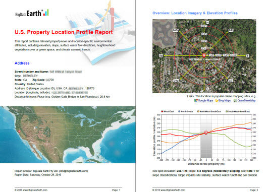
The new property location information report goes beyond common imagery and basemaps, and focuses on spatial measurement and modeling which enables users to make informed location-based decisions.
A series of samples can be seen at BigData Earth website http://www.bigdataearth.com/
This whole project demonstrates the application potential of location intelligence products by using Geospatial Big Data Analytics and Global Earth Observation.
