Asian Surveying & Mapping
Breaking News
Ecolab and ITE partners to harness water management knowledge for Singapore data center engineers
SINGAPORE, 29 APRIL 2024 – Nalco Water, an Ecolab...
NASA releases satellite photos of Dubai and Abu Dhabi before and after record flooding
NASA released photos of parts of Dubai and Abu...
Singapore releases 10-year Geospatial Master Plan
Singapore has launched its new Geospatial Master Plan (2024–33),...
Japan announces plans to launch upgraded observation satellites on new flagship rocket’s 3rd flight
TOKYO (AP) — Japan’s space agency announced Friday a...
Tesla China partners with Baidu for maps to clear FSD hurdle
Amidst Elon Musk’s unannounced trip to Beijing, China this...
ESA opens ideas factory to boost space innovation in Austria
A centre to innovate the design and manufacture of...
Japan’s space agency sets June 30 as third launch date for H3 rocket
The Japan Aerospace Exploration Agency (JAXA) announced Friday that...
S. Korea launches nanosatellite for Earth observation
SEOUL- A South Korean nanosatellite was launched into orbit...
Australian Space Agency funds development of aerospace-grade GNSS receiver
The Australian Space Agency has funded the development of...
Continuity risks for Australian EO data access
A new report details the widespread use of Earth...

February 5th, 2016
Korean Geotechnology Company Selects SuperGIS Desktop to Process Spatial Data

Supergeo Technologies Inc., the total GIS software and solution provider announces that Nexgeo has selected SuperGIS Desktop for processing and visualizing geospatial data.

Headquartered in Seoul, Nexgeo is a Korean consulting firm and construction contractor involved with solving various geo-related tasks, such as building a geological resource database, creating a disaster monitoring system and developing geothermal energy capacity since its establishment in 2001.

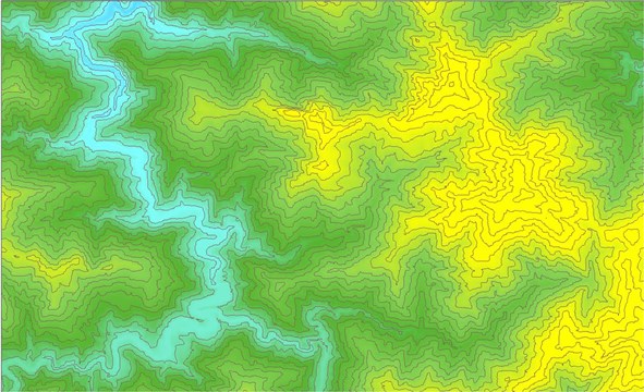
With its advanced GIS technology, Supergeo products are frequently selected by customers from different countries including those that have a robust domestic IT industry like the US, the UK or in this case, Korea. SuperGIS Desktop is full-featured Desktop GIS software, which can deliver exceptional performance and efficiency for a company like Nexgeo. In addition to basic GIS functions like Buffer, Clip or Union, technicians in a geotechnology company can calculate slope, aspect, curvature of a specified area and create isarithmic maps through the 3D analyst extension of SuperGIS Desktop, which can significantly reduce the time and resources spent on these tasks. Supergeo also has long-term experience in developing Server GIS and Mobile GIS, which can help users to establish an online map platform or to survey various landscapes with ease.