Mapping and location intelligence experts Esri Australia partnered with the AKF to develop the user-friendly portal that provides an accurate account of koalas’ wild habitats, irrespective of land ownership. Australia Koala Foundation OAM CEO Deborah Tabart said she was excited to see more than $8 million worth of research and 25 years of koala information available to the public in such an accessible and readily usable form. “Koalas can never be protected until their trees are,” said Ms Tabart. “Esri Australia has taken our existing maps and extensive information database and transformed them into a web tool which enables the community to get involved.
“The community can ‘truth’ our data by telling us what is on the ground. “The online maps are simple to use and the information is displayed with easy to understand images.
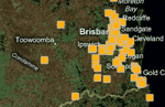
“It will show people ‘yes, I live in koala habitat’ or ‘no I don’t’. This is the first key step for protection of the koala.”
Esri Australia Managing Director Brett Bundock said his company shared the AKF’s commitment to preserving Australia’s koala populations and was delighted to be a part of the initiative.
“Esri Australia has a proud history in the space of environmental science research and we are very excited about the potential of KoalaMap,” Mr Bundock said.
“Koalas are an important part of our national identity and it’s important that we do whatever we can to ensure they are protected.” Mr Bundock said Esri Australia drew on its expertise as Australia’s premier Geographical Information Systems (GIS) company to produce the sophisticated mapping application behind KoalaMap. “We’re fortunate to have the largest team of GIS and location intelligence experts in the country,” he said.
“We’re very proud to put the weight of that experience and technical knowledge behind this enormously rewarding project.” Ms Tabart said the AKF hoped the mapping application would bolster their efforts to have the koala listed as a vulnerable species by the Federal Government.
The KoalaMap portal can be located at: http://koalamap.savethekoala.


