Asian Surveying & Mapping
Breaking News
Launch of Australia’s 1st orbital rocket, Gilmour Space’s Eris-1, delayed again
Update for 6:15 p.m. ET on July 1: Gilmour Space...
SAASST, UAE Space Agency strengthen scientific partnership
SHARJAH- Prof. Hamid M.K. Al Naimiy, Director of the...
Shubhanshu Shukla to speak to students and ISRO scientists this Friday
Indian astronaut Shubhanshu Shukla will interact with school students...
ISRO hands over 10 advanced technologies to Indian firms in major push for space commercialisation
The Indian Space Research Organisation (ISRO) has transferred ten...
DIGIPIN Launched: India Embraces Geospatial Precision in Digital Addressing
IIT Hyderabad (IITH), in partnership with the Department of...
HAL to build, market Isro’s SSLV in landmark deal
New Delhi, Jun 20: In a historic move for...
Taiwan developing space capabilities for all-weather imaging
TAIPEI (TVBS News) — Taiwan is advancing its space...
Honda hails successful test of reusable rocket as it looks to get into the space business
Tokyo — Japan's second-biggest carmaker, Honda, has successfully tested...
China’s space program provides larger platform for broader international cooperation
BEIJING -- Experts from China's manned space program said...
India To Launch $1.5 Billion Joint Earth Mission With NASA In July
National Aeronautics and Space Administration (NASA) and the Indian...

gps

Monday, February 7th, 2011

Emercom to Use GLONASS for Transport Monitoring

Russian EMERCOM plans to arrsange monitoring of the transport vehicles, including those used to transport hazardous cargo, with the help of GLONASS/GPS navigation system, EMERCOM PAO reports. The Ministry also intends to improve its accident response system through...

Tuesday, January 25th, 2011

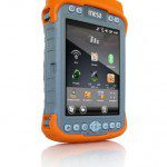
Juniper Systems – Mesa Geo 3G Rugged Notepad

Juniper Systems is proud to announce that the Mesa Geo 3G Rugged Notepad is now available for shipment. In addition to all of the features available on the Mesa Geo model (Bluetooth® wireless technology, Wi-Fi®, GPS, and...

Tuesday, January 25th, 2011

STMicroelectronics – Single-Chip Multiple Global Navigation Systems

TMicroelectronics today introduced Teseo II, a new generation of single-chip stand-alone positioning receivers for Portable Navigation Devices, in-car navigation and telematics applications. These Systems-on-Chips are the industry's first monolithic devices capable of receiving signals from multiple satellite...

Monday, January 24th, 2011

Country Sees Its First Wild Tiger Translocation

For the first time in Nepal, a wild tiger fitted with satellite collar was translocated from the Chitwan National Park (CNP) to Bardia National Park (BNP) today. CNP authorities had rescued the injured male tiger from the...

Saturday, January 22nd, 2011

Thammasat Passengers Set for GPS Safety Boost

Public vans commuting between Thammasat University Rangsit campus and inner-city areas will soon be equipped with GPS tracking devices to boost safety for passengers. The TU Rangsit campus public van station will be the first in the country...

Monday, January 17th, 2011

India Builds Its Own GPS

India recently announced that it is going to have its very own Global Positioning System (GPS) by 2014. This was driven more by feelings that India was lagging too far behind China. While India’s $355 million Indian...

Saturday, January 15th, 2011

Japan-United States GPS Cooperation Enhanced “for Peaceful Purposes“

The Governments of the United States of America and Japan convened a plenary meeting in Tokyo, Japan on January 13, to review and discuss cooperation in the civil use of the Global Positioning System (GPS) and GPS...
Wednesday, January 12th, 2011

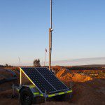
Leica Geosystems Launch Terrestrial GPS Augmentation Network

Mining fleet management specialists Leica Geosystems have launched their GPS Augmentation Network, incorporating exclusive technology developed by Locata Corporation.

Thursday, January 6th, 2011

New SPIRENT GSS6400 GNSS Test

Whether developing navigation algorithms, performing vendor selection, evaluating receiver variants or establishing the performance of a PND under real world conditions you will need a repeatable representative high quality GPS signal. And sometimes testing using real world...

Monday, January 3rd, 2011

Migratory Birds at Pong Dam to be Tracked with Radio Collars

Till now, wildlife scientists and officials have been using GPS (global positioning system) tracking for wildlife. This is, perhaps, the first time when the department has chosen to study migratory patterns of the birds, a large number...

Page 15 of 16 1 10 11 12 13 14 15 16