Asian Surveying & Mapping
Breaking News
Astranis clinches $115 million Taiwan deal despite satellite setback
TAMPA, Fla. — Astranis has signed a $115 million...
UAE and Egypt Strengthen Space Collaboration with New MoU
In a milestone development for Arab space collaboration, the...
Seoul launches 4th spy satellite to boost North Korea surveillance
South Korea’s military now operates an increasingly integrated cluster...
Indonesia seeks space defense cooperation with Japan’s military
Jakarta (ANTARA) - The Ministry of Defense of Indonesia...
China Launches 3 Astronauts To Its Space Station
The spacecraft Shenzhou-20 and the crew lifted off atop...
Former Isro chairman K Kasturirangan dies in Bengaluru at 84
Dr. Kasturirangan led the Isro, the Space Commission, and...
South Korea is converting an abandoned coal mine into a moon exploration testing ground
South Korea is transforming abandoned coal mines into testing...
ISRO to Launch Chandrayaan-5 With Japan, Plans Space Station
Dr. V. Narayanan, Chairman of the Indian Space Research...
Russia and China are threatening SpaceX’s Starlink satellite constellation, new report finds
SpaceX's Starlink satellite constellation is facing threats from Russia...
China and Pakistan agree to fly 1st foreign astronaut to Chinese space station
For the first time, the Chinese space program will train...

GNSS

Wednesday, November 9th, 2011

Leica GR25 GNSS Reference Server

The Leica GR25 GNSS Reference Server is more than just a reference receiver. With integrated internal and external device management, multi-user management, high end security, modular and scalable design, the GR25 GNSS Reference Server will grow with...

Monday, November 7th, 2011

New Leica mojoXact – Leica mojo3D and Leica SteerDirect Now Available

Leica Geosystems today released the Leica mojoXact, the new high accuracy upgrade option for the Leica mojo3D guidance display, as well as further features for the Leica mojo3D and Leica SteerDirect. The new features include an improved...

Sunday, October 30th, 2011

Spirent – New Support for China’s Compass Sat

In response to recent public announcements on the readiness of the Beidou-2 navigation system and the planned release of the signal Interface Control Document, Spirent Communications plc, the leading provider of navigation and positioning test solutions, today...
Friday, October 21st, 2011

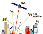
QZSS Multi-GNSS Experiment for Asia-Oceania

The Quasi-Zenith Satellite System (QZSS) is a constellation of multiple satellites, with at least one satellite positioned near zenith over Japan at anytime. The purpose of the system is to enable improved satellite coverage, thereby enhancing the...

Thursday, October 20th, 2011

VERIPOS Opens Office in Australia

VERIPOS has extended its Asia Pacific operations with the opening of a branch office in Australia, in April. The facility is based in Perth and will provide sales and support for both Australia and New Zealand. Bernard He...

Wednesday, October 19th, 2011

Spirent Adds QZSS Support to its Multi-GNSS Simulation Platform

Spirent Communications plc (LSE: SPT), the leading provider of navigation and positioning test solutions, announced  the addition of Japanese Quasi Zenith Satellite System (QZSS) simulation capabilities to its GSS6700 Multi GNSS Constellation Simulator, enhancing the ability to...

Monday, October 17th, 2011

Russia’s Soyuz Ready to Launch Galileo

The Soviet-era workhorse launches from Europe's space base in South America in the first time the rocket, which traces its lineage to Sputnik and Gagarin, has been deployed outside Russia's bases. And its payload will be the first two...

Thursday, October 13th, 2011

AEROoffice & TERRAoffice v5.3 Released

IGI recently announced a new major release of its leading post-processing software AEROoffice & TERRAoffice - version 5.3. TERRAoffice is a branch of AEROoffice and corporates special features for StreetMapper & RailMapper users. There are major improvements within...

Tuesday, October 4th, 2011

NZ Government GNSS CORS

The NZGD2000 Government CORS provides the locations of GNSS Continuously Operating Reference Stations operated by GNS Science under the GeoNet project (www.geonet.org.nz). Coordinates are from the LINZ Geodetic Database, in NZGD2000. These are split into several different...

Tuesday, October 4th, 2011

Zenith 10 & Zenith 20: The Complete GNSS RTK Solution from GeoMax

A new member of GeoMax’s complete and...

Page 9 of 22 1 4 5 6 7 8 9 10 11 12 13 14 22