
Asian Surveying & Mapping
Breaking News
South Korea is converting an abandoned coal mine into a moon exploration testing ground
South Korea is transforming abandoned coal mines into testing...
ISRO to Launch Chandrayaan-5 With Japan, Plans Space Station
Dr. V. Narayanan, Chairman of the Indian Space Research...
Russia and China are threatening SpaceX’s Starlink satellite constellation, new report finds
SpaceX's Starlink satellite constellation is facing threats from Russia...
China and Pakistan agree to fly 1st foreign astronaut to Chinese space station
For the first time, the Chinese space program will train...
ISRO’s “Space on Wheels” offers a peek into Indian Space Programme to students in Karimnagar
The Indian Space Research Organisation (ISRO)’s “Space on Wheels”...
Geospatial led solutions build the foundations for better decision-making
Geo Connect Asia 2025 paves the way for turning...
GEOSA, Singapore Land Authority Launch Achievements of Joint Geospatial System Project
Riyadh, SPA -- The General Authority for Survey and...
Building in Bangkok collapses as powerful earthquake hits southeast Asia
One person has died and 50 were injured in...
Bellatrix Aerospace Partners with Astroscale Japan for Space Debris Removal
Bellatrix Aerospace, a Bengaluru-based space mobility company, has joined...
NSTC announces Pingtung site as Taiwan’s space mission launch center
Taipei, March 26 (CNA) Taiwan's National Science and Technology...

GIS

image

Tuesday, May 3rd, 2011

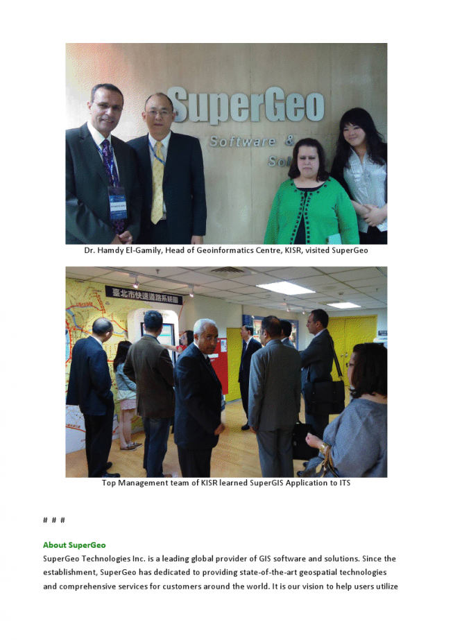
Kuwait Institute for Scientific Research Visit SuperGeo for Geospatial Innovation

SuperGeo Technologies is honored to be visited by Kuwait Institute for Scientific Research (KISR). The two parties had fruitful discussion about the geospatial applications and innovative collaboration by using GIS technologies. KISR was invited by Institute for Information Industry (III),...

Monday, May 2nd, 2011

Workshop on GIS Tool Kit for Schools

A workshop on the GIS Tool Kit for Schools will be conducted in Thailand on May 24 and 25, 2011. This workshop is organized by the Geo-Informatics and Space Technology Development Agency (GISTDA) of Thailand within the framework of the...

Friday, April 29th, 2011

ASM Newsletter – April 29, 2011

If you have trouble viewing this newsletter, click here to view in a browser ASM Website Calendar Submit Editorial Cloud-Based Mapping Tools Emerge to Appeal to Enterprise UsersThe move to cloud-hosted Geographic Information Systems seems to be...

Tuesday, April 26th, 2011

Airman Aims High with Online GIS Degree

When it comes to GIS (Geographic Information Systems) technology, Air Force Tech Sgt. and American Sentinel University student John Spence, understands the growing need for GIS professionals. Based in Tokyo, Japan, Spence is the chief of programs...

Friday, April 22nd, 2011

ASM Newsletter – April 22, 2011

If you have trouble viewing this newsletter, click here to view in a browser ASM Website Calendar Submit Editorial India Successfully Launches Resourcesat-2 The Indian Space Resource Organization successfully launched the remote sensing satellite Resourcesat-2 and two...

Wednesday, April 20th, 2011

GIS Supports Airports Around the Globe

terry_bills_and_ian_koeppelAirports are changing around the globe. New technologies and economic pressures are causing them to evaluate their operations and to become more responsive and efficient. Geographic...

Tuesday, April 19th, 2011

National College to Start Diploma in Remote Sensing

National Post Graduate College will introduce post-graduate diploma in geographical information system (GIS) and remote sensing, and retail management from the 2011-12 academic session. "The course of these kinds are not being run by higher education institutions...

Friday, April 15th, 2011

ASM Newsletter – April 15, 2011

If you have trouble viewing this newsletter, click here to view in a browser ASM Website Calendar Submit Editorial Online Imagery Continues to Improve Aerial digital cameras and satellite imagery sensors continue to improve their resolution, with...

Tuesday, April 12th, 2011

Trimble Demonstrates Field Service Work Management Integration with Microsoft Dynamics

Trimble announced today that it will demonstrate how its new cloud-based field service solution—Trimble GeoManager WorkManagement—integrates with Microsoft Dynamics CRM at Microsoft Convergence 2011. Trimble WorkManagement is a software solution that provides on-demand visibility into vehicle and...

Sunday, April 10th, 2011

GIS Maps to be Linked with Data on Households for Census

As part of a countrywide exercise, the Census Directorate will undertake GIS mapping of 647 statutory towns and 1.06 lakh villages in Uttar Pradesh, which will show each and every house and the number of people living...

Page 24 of 27 1 19 20 21 22 23 24 25 26 27