Friday, January 20th, 2017
Bird.i, the premiere global platform for accessing the world’s best satellite, airborne and drone imagery, has today announced that it has closed a strategic partnership agreement with leading British aerial image supplier Bluesky International Ltd. Bird.i is...
Tuesday, September 22nd, 2015
Montreal, Canada, September 22nd, 2015 – SimActive Inc., a world-leading developer of photogrammetry software, is pleased to announce that AeroVironment has selected Correlator3D™ for post-processing UAV imagery. “We required an advanced photogrammetry solution to process large datasets...
Wednesday, April 22nd, 2015
COPENHAGEN/MONTREAL, April 22, 2015 — Phase One Industrial, a leading manufacturer and provider of medium format aerial and industrial digital photography equipment, and SimActive Inc., a world-leading developer of photogrammetry software have announced an integrated software...

Wednesday, March 21st, 2012
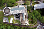
For the first time Singaporean authorities have given permission for a photogrammetric UAV mapping/modeling flight over an important area of the city. In the context of the SEC-FCL (Future Cities Laboratory) project a pilot study is conducted...

Thursday, November 10th, 2011
The 53rd Photogrammetric Week was held in Stuttgart, Germany, from 5-9 September 2011 with 380 participants from 45 countries. The conference proved to be a very informative event with developments in new digital aerial cameras, lidar...
Sunday, July 10th, 2011
The aim of the toolkit is to show managers, scientists and technicians working in marine, terrestrial and atmospheric environments how images collected from satellites and aircraft (remote sensing) can be used to map and monitor environmental features...
Tuesday, June 28th, 2011
Our newest flight path explores the ancient cultures and landforms that lie between the two expanding cities of Cairo and Doha. Covering the deserts of Egypt, Jordan, Saudi Arabia and Qatar, the flight path reveals the true value of water in the development of...
Tuesday, May 3rd, 2011
VisionMap LTD, a leading provider of digital mapping systems, announced today that A3 ground processing system version 2.0 is now released. The new ground processing system, together with A3 camera improvements now feature better radiometry, higher resolution...
Friday, February 11th, 2011
Bing Spatial Data Services, a next generation spatial search offering added to the Bing API. This new service offers the benefits of cloud hosting and distributed computing, allowing customers to upload their data to Microsoft’s servers and...