Asian Surveying & Mapping
Breaking News
Neo Space Group Completes Acquisition of UP42 from Airbus Defence and Space
Neo Space Group (NSG) has officially finalized its acquisition...
Launch of Australia’s 1st orbital rocket, Gilmour Space’s Eris-1, delayed again
Update for 6:15 p.m. ET on July 1: Gilmour Space...
SAASST, UAE Space Agency strengthen scientific partnership
SHARJAH- Prof. Hamid M.K. Al Naimiy, Director of the...
Shubhanshu Shukla to speak to students and ISRO scientists this Friday
Indian astronaut Shubhanshu Shukla will interact with school students...
ISRO hands over 10 advanced technologies to Indian firms in major push for space commercialisation
The Indian Space Research Organisation (ISRO) has transferred ten...
DIGIPIN Launched: India Embraces Geospatial Precision in Digital Addressing
IIT Hyderabad (IITH), in partnership with the Department of...
HAL to build, market Isro’s SSLV in landmark deal
New Delhi, Jun 20: In a historic move for...
Taiwan developing space capabilities for all-weather imaging
TAIPEI (TVBS News) — Taiwan is advancing its space...
Honda hails successful test of reusable rocket as it looks to get into the space business
Tokyo — Japan's second-biggest carmaker, Honda, has successfully tested...
China’s space program provides larger platform for broader international cooperation
BEIJING -- Experts from China's manned space program said...

News

Thursday, February 18th, 2016

ISRO to Double Missions to 12 Per Year

Having launched 55 missions in space in the last five years, the national space agency ISRO is looking at doubling the number of missions in the next five years to an average of 12. Read More via...

Wednesday, February 17th, 2016

PH has 400 More Islands, says Mapping Agency—Report

The Philippines may have 400 more “previously unknown” islands in addition to the 7,107 on record. Read More via Inquirer

Wednesday, February 17th, 2016

Smart Maps May Hit the Streets this Year or Next

LAS VEGAS -- You've doubtless heard about "smart" maps that let cars locate and communicate with other vehicles, stoplights and anything else encountered on the street. Read More via Automotive News

Wednesday, February 17th, 2016

Haryana Soon to Become First State to Complete Water Mapping

Mapping of underground water in Haryana will be completed by May and the state will become the first to do so, according to sources. Read More via I am in DNA

Tuesday, February 16th, 2016

Kim Jong-Un Vowing to put More Satellites into Space

North Korea's leader is promising to put more satellites into space, despite international condemnation of their most recent launch. Read More via Newstalk
Monday, February 15th, 2016

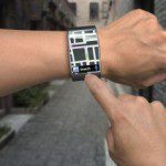
GPS Tracking Down to the Centimeter

Researchers at the University of California, Riverside have developed a new, more computationally efficient way to process data from the Global Positioning System (GPS), to enhance location accuracy from the meter-level down to a few centimeters. The...

Monday, February 15th, 2016

India-Launched Satellite Performing Well: Singapore

SINGAPORE: Singapore today said its first satellite launched by India was performing well and it was developing a second much-larger "Next Gen Satellite" to enhance its remote-sensing capabilities. Read More via Economic Times

Friday, February 12th, 2016

Jordan Launches $1.1M EU-Funded Twinning Real Estate Mapping Project

The EU and the Department of Lands and Survey (DLS) on Tuesday launched a 1 million euro twinning project aimed at enhancing the technical and administrative capacities of the DLS in the fields of cadastre (mapping real...

Friday, February 12th, 2016

Japan’s X-Ray Satellite Astro-H Will Soon Blast Off to Space

Japan Aerospace Exploration Agency's (JAXA) newest (and sixth!) X-ray observatory is leaving for space on Friday to study black holes and galaxy clusters. It's called Astro-H, and it's blasting off with several scientific instruments in tow. These...

Friday, February 12th, 2016

Sokkia Releases SHC500 Field Controller

LIVERMORE, Calif. – February 11, 2016 – Sokkia introduces an addition to its line of field controllers for construction and surveying applications — the SHC500. It is designed to provide operators a compact handheld option with numerous features...