Wednesday, January 11th, 2012
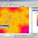
SuperGIS Network Analyst 3 is the powerful analysis tool for the control, simulation, design, and planning of various network conditions. Except for finding the shortest path, SuperGIS Network Analyst 3 comprises closest facilities, service area, vehicle routing problem, and...
Thursday, January 5th, 2012
To establish a service platform within a single intranet and effectively manage and integrate various types of data, Asia Pacific Telecom adopts SuperGIS Server as the core of the GIS platform. The enterprise GIS management platform allows...
Thursday, January 5th, 2012
SuperGeo Technologies, the leading global provider of complete GIS software and solutions, announced that the Forest Utilization Monitoring Center of Central Region, Indonesia (Balai BP2HP Wilayah XVIII Manokwari) purchased SuperGIS Desktop 3 from the local reseller, Datascrip....
Wednesday, January 4th, 2012
NovAtel Connect is a windows-based GUI that provides easy access your receiver’s many features without the need to use a terminal emulator or to write special software. NovAtel Connect lets you communicate and configure your receiver via...
Sunday, January 1st, 2012
Geo Tactical Solutions (GTS) is in the final stages of development for its new photo mapping and management software—PhotoGIS. PhotoGIS, planned to be released in early first quarter 2012, will allow users to easily map, organize, export...
Thursday, December 29th, 2011
SuperSurv is the application designed for field survey with android mobile device. It integrates GIS and GPS technologies, which also supports global coordinate system. Thus, you can collect, display, and manipulate GIS data correctly with SuperSurv.

Wednesday, December 21st, 2011
SuperGeo Technologies introduces SuperGIS Spatial Analyst 3, the spatial processing tool working with SuperGIS Desktop 3.1 to complete advanced spatial analyses and tasks. Designed for deriving information from geo-applications, the newly developed SuperGIS Spatial...
Sunday, December 18th, 2011
PortVision today announced the SmartOps Fleet Management System, which extends the benefits of the company’s AIS-based vessel-tracking system to provide an enterprise resource management system and automate a comprehensive range of unit tow business processes.

Tuesday, December 13th, 2011
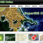
SuperGeo announces that SuperGIS Online Website is officially launched, making the GIS data and services accessible through the Internet.
Thursday, December 8th, 2011
The uDig Community is pleased to announce the release of uDig 1.3.0. This release is made in conjunction with GeoTools 8.0-M4. Thanks to Andrea Amie and Gabriel Roldan for support, encouragement and timely bug fixes. This point release...