
Recognition highlights Maptitude for territory mapping, demographic analysis, and the highest geocoding and likelihood-to-recommend scores in the guide, based on verified G2 user reviews
NEWTON, MA (USA) – Maptitude has been named one of the six best GIS software tools for mapping in 2026 in a new buyer’s guide published by G2, the world’s largest software marketplace. The guide, “I Compared the 6 Best GIS Software Tools for Mapping (2026),” recognizes Maptitude as the best solution for territory mapping and demographic analysis, drawing on G2 Grid Report data and verified user reviews.
 The guide evaluated six widely used GIS platforms across spatial analysis, mapping capabilities, geospatial data management, ease of implementation, scalability, integrations, and overall user experience. Among the platforms compared, Maptitude earned the highest Likelihood to Recommend score in the lineup, at 94%.
According to G2 data cited in the guide, Maptitude scored 98% on geocoding, the highest in the category lineup, along with 97% on data capture. These results point to strong user confidence in how reliably Maptitude turns address lists and location-based datasets into accurately plotted maps.
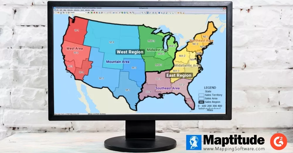
The guide identifies territory mapping and management as the capability driving the majority of positive Maptitude reviews, with users describing how they build, adjust, and balance sales territories, service zones, and operational regions using tools designed for that work. It also highlights the bundled demographic and geographic data that ships with the platform, site selection and market analysis tools used across retail, real estate, and franchise development, and geocoding at scale for operations and logistics teams. The guide notes that Maptitude makes sophisticated spatial analysis accessible to business analysts who do not have deep GIS expertise.
“Maptitude was built to give business teams the full power of a professional GIS platform without the complexity or the cost that usually comes with it. Being recognized by G2 as the best choice for territory mapping and demographic analysis, with the highest geocoding and likelihood-to-recommend scores in the guide, reflects exactly what our users tell us every day. They want accurate location data, powerful analysis, and tools they can put to work immediately.”
Stewart Berry, Vice President, Maptitude
The recognition is grounded in the experience of verified users who rely on Maptitude to make location-driven decisions. One verified G2 reviewer described the practical value of the platform and its built-in data:
“What I like best about Maptitude is how practical and user-friendly it is for GIS work. I have been using it since 2021, and it has become my go-to software for mapping, spatial analysis, and research-related GIS tasks. The built-in data is especially useful because it saves time and makes the workflow much easier compared to many other GIS platforms where data preparation can take a lot of effort.”
Muhammad Arif Qaisrani, verified Maptitude review on G2
Maptitude is relied on by organizations worldwide, including Fortune 500 companies, government agencies, and nonprofits, to solve location-based challenges across industries. The built-in demographic and boundary data, combined with advanced spatial analysis and territory management tools, allows users to derive actionable insights from geographic data without requiring specialized GIS expertise.
For teams that need to distribute location insights across an organization, Maptitude is also available as Maptitude Online, a cloud-based edition that lets users create and share maps directly in a web browser. Together, the desktop and online editions give organizations flexibility in how they build and share maps and location intelligence.
The full guide is available at learn.g2.com/best-gis-software.
For more information about Maptitude, please visit the Maptitude website.
About Maptitude
Maptitude is a GIS, mapping software, and location intelligence platform developed by Caliper Corporation. Launched in 1995, Maptitude empowers thousands of organizations worldwide, from Fortune 500 companies to government agencies and nonprofits, to harness the full potential of location intelligence. Its advanced spatial tools and extensive built-in demographic data enable precise site selection, market analysis, sales territory design, and optimized routing, while minimizing the need for costly third-party data purchases. Available for both desktop and online use, Maptitude integrates with popular data platforms and is accessible to both GIS professionals and business users. Maptitude also supports educational initiatives with free licenses for students and educators.
About the G2 Buyer’s Guide
G2 publishes buyer’s guides that compare leading software products within a category to help buyers evaluate their options. The 2026 GIS software guide assessed widely used platforms using G2 Grid Report data, satisfaction scores, market presence, and verified user reviews, with an emphasis on the capabilities that matter most in real-world geospatial workflows, including location intelligence, geocoding, route optimization, geographic data visualization, and the ability to manage large geographic datasets. The guide is available on the G2 Learn Hub.
About G2
G2 is the world’s largest and most trusted software marketplace. More than 100 million people annually, including employees at all Fortune 500 companies, use G2 to make smarter software decisions based on authentic peer reviews. Thousands of software and services companies of all sizes, including Salesforce, HubSpot, Zoom, and Adobe, partner with G2 to build their reputation and grow their business. To learn more about where you go for software, visit www.g2.com and follow G2 on LinkedIn.
