
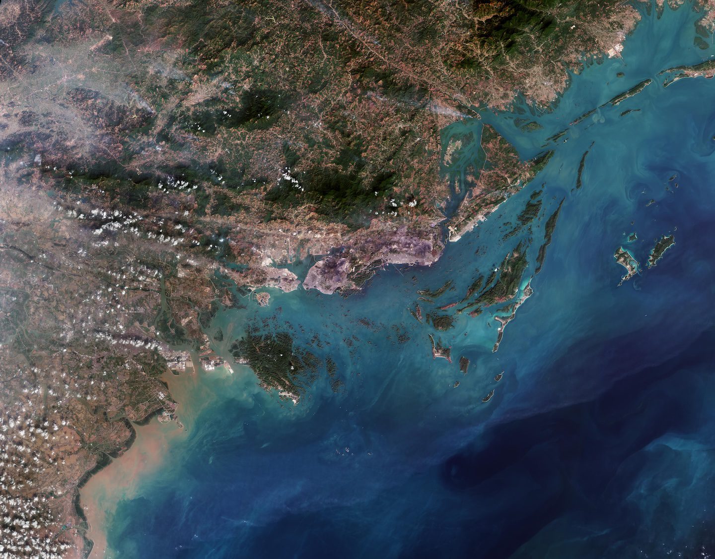
This Copernicus Sentinel-2 image showcases striking rocky formations amid the blue waters of Halong Bay in northeast Vietnam.
Halong Bay spans about 1500 square kilometers along the northwest coast of the Gulf of Tonkin, the northwest extension of the South China Sea. Designated a UNESCO World Heritage site in 1994, the bay is home to a dense cluster of islands and islets, varying in shape and size, jutting from the sea as jagged limestone pinnacles. Each island is topped with thick, evergreen vegetation, while several conceal enormous caves and grottoes within.
A significant portion of the population depends on the bay for tourism, pearl farming, marine aquaculture and fishing. Around 1,700 people reside in traditional floating fishing villages and maintain a way of life connected to the water. Brown rectangular features visible in the image across the bay show structures associated with these activities.
There are two bigger islands within the bay that have permanent inhabitants: Tuần Châu and Cát Bà.
Cát Bà island, visible in green in the lower left of the image, features a landscape of rugged hills and narrow valleys. Renowned for its rich biodiversity, the island is home to a national park, established in 1986 to protect its diverse terrestrial and aquatic ecosystems.
North of Cát Bà lies Tuần Châu island, one of Halong Bay’s most popular tourist destinations. The island features two purpose-built beaches of fine, white sand, visible to the east and south. A 2-kilometer road to the north links the island to the mainland and the port city of Halong.
Halong, the capital of the province, has an economy primarily driven by tourism and coal mining. The distinctive concentric patterns of open-pit coal mines are clear to spot to the east appearing in shades of violet owing to the exposed leftover soil.
About 40 kilometers southwest, facing Cát Bà island, lies Haiphong, Vietnam’s third-largest city and a key industrial hub. Strategically positioned on the northeastern edge of the Red River Delta, Haiphong serves as the main port for the capital Hanoi (not pictured) and is the largest coastal city in northern Vietnam.
Image Credit: Contains modified Copernicus Sentinel data (2025), processed by ESA
