
Multiple recent incidents in which naval and commercial vessels ran aground have highlighted the dangers of maritime operations in shallow or poorly charted coastal waters. TCarta Marine of Denver offers a cost-effective, environmentally safe solution using Earth observation satellites to derive accurate water depth measurements in near-shore areas.
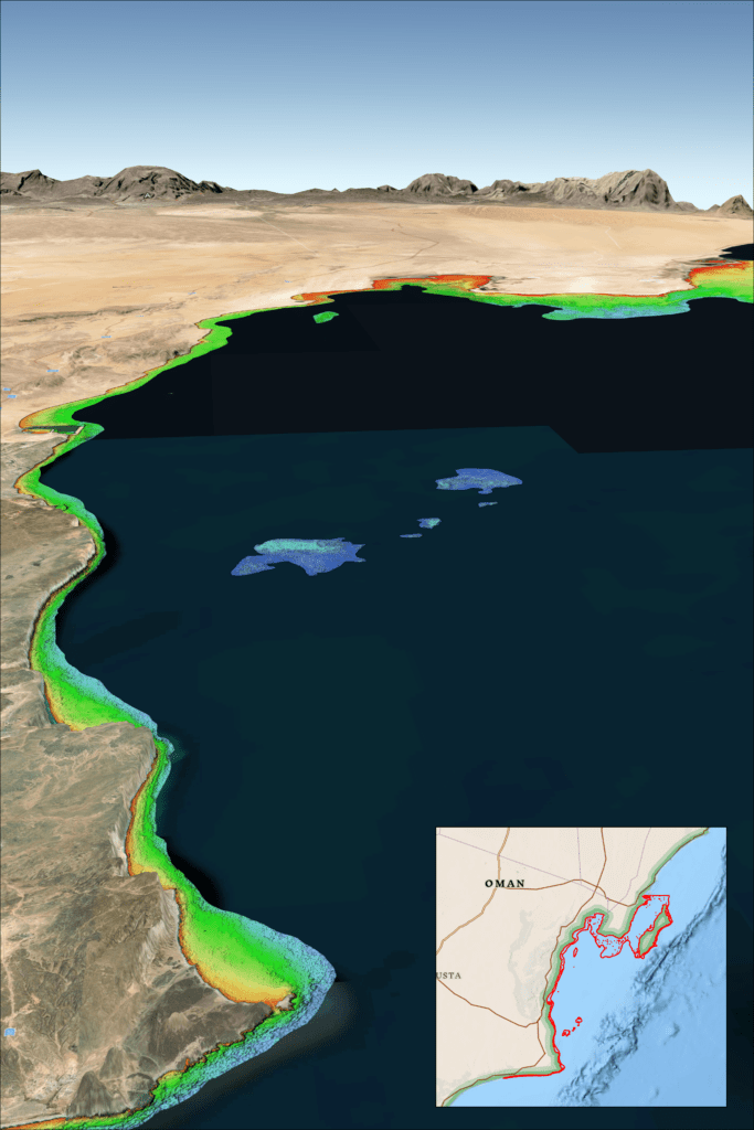
“While the exact causes of recent ship groundings off the coasts of Oman, Greenland, and Fiji are under investigation and often complex, the risk of such accidents can be significantly reduced with up-to-date bathymetric data produced from satellite imagery,” said TCarta President Kyle Goodrich. “Often in coastal areas, the regions outside commercial shipping lanes are poorly charted or not surveyed.”
Unfortunately, the collection of high-quality water depth measurements in shallow coastal areas – where they are needed the most – has traditionally been expensive and dangerous to acquire with ships or aircraft, especially in remote or contested regions, Goodrich said. And the risk of groundings is only growing as military vessels and eco-tourism charters increasingly operate in unfamiliar and inadequately mapped coastal zones.
For over 10 years, TCarta has been supplying marine charting organizations with water depth data using a technique called Satellite Derived Bathymetry (SDB). SDB applies physics-based computer algorithms to optical imagery captured by commercial remote sensing satellites. This analysis detects and measures light reflecting off the seafloor to calculate water depth. Depending on water clarity, SDB is routinely accurate to depths of 20 to 30 meters.
“In addition to posing no danger to personnel, equipment, or coastal environments, satellites are more cost effective than ship-borne sonar or airborne laser scanning because they acquire image data over large regions in seconds,” said Goodrich. “And because satellites orbit without geographic restrictions, data can be collected for areas otherwise off limits to vessels or aircraft.”
TCarta has mapped nearly one third of the world’s coastlines with SDB and offers products in custom and off-the-shelf versions. Custom SDB data sets are typically generated using high-resolution satellite imagery capable of resolving seafloor objects, such as shoals and reefs, with one-meter resolution.
The off-the-shelf bathymetry product Global Satellite Derived Bathymetry (G-SDB) offers 10-meter detail and is ideal for identifying coastal shoals in remote areas that don’t appear on nautical charts. Large-area contiguous G-SDB products are immediately available for more than a dozen critical locations, including:
Government and commercial organizations may order bathymetry products directly from TCarta or through the GSA Schedule.
