The most significant release of UgCS, the best and most powerful flight planning tool for drone pilots, has landed!
SPH Engineering is proud to announce the release of UgCS 5.0, marking a major milestone in drone flight planning software evolution.
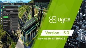
The biggest UgCS update in years is bringing along a refreshed and more friendly user interface.
New UgCS 5.0 is inspired by the professional drone pilot community’s feedback, allowing pilots to tackle complicated projects and fly with LiDAR.
This update is a significant step toward making drone flight planning faster and more intuitive than ever before.
Modern Interface. Simplified Flight Planning.
Simplified process for easy access and efficiency.
Faster file import/export
Uses the default OS dialog for seamless file handling.
Revised telemetry/commands panel
Focuses on crucial flight information.
Accessible flight overview
Flight details are quickly accessible in the top bar.
Resizable and adjustable to fit your needs
Easily rescale for use on any screen size.
Quick Mode Switching
Effortless transition enhances planning and analysis.
UgCS is one of the longest-standing flight planning software programs, with more than 10 years of experience in the drone industry.
With UgCS modern interface and simplified flight planning, it is possible to:
Circle mission
SPH Engineering, the developer behind UgCS, continues to lead in multi-platform flight planning solutions, supporting an extensive range of drones from top manufacturers like DJI, Freefly, Inspired Flight, and others featured on the Blue UAS list. UgCS is engineered to empower pilots to capture accurate data efficiently, minimize risks, and deliver high-quality results that meet the demands of commercial clients.
Don’t miss out on experiencing flight planning like never before with UgCS 5.0.
Get your license today and enjoy planned flights with terrain following, a 3D flight planning interface, offline maps (fly without an internet connection), and other unique features.[ugcs.com] (https://www.sphengineering.com/flight-planning/ugcs)
Simplify drone flight planning to focus on more important things in your life.
