Asian Surveying & Mapping
Breaking News
Ecolab and ITE partners to harness water management knowledge for Singapore data center engineers
SINGAPORE, 29 APRIL 2024 – Nalco Water, an Ecolab...
NASA releases satellite photos of Dubai and Abu Dhabi before and after record flooding
NASA released photos of parts of Dubai and Abu...
Singapore releases 10-year Geospatial Master Plan
Singapore has launched its new Geospatial Master Plan (2024–33),...
Japan announces plans to launch upgraded observation satellites on new flagship rocket’s 3rd flight
TOKYO (AP) — Japan’s space agency announced Friday a...
Tesla China partners with Baidu for maps to clear FSD hurdle
Amidst Elon Musk’s unannounced trip to Beijing, China this...
ESA opens ideas factory to boost space innovation in Austria
A centre to innovate the design and manufacture of...
Japan’s space agency sets June 30 as third launch date for H3 rocket
The Japan Aerospace Exploration Agency (JAXA) announced Friday that...
S. Korea launches nanosatellite for Earth observation
SEOUL- A South Korean nanosatellite was launched into orbit...
Australian Space Agency funds development of aerospace-grade GNSS receiver
The Australian Space Agency has funded the development of...
Continuity risks for Australian EO data access
A new report details the widespread use of Earth...

Australia is no stranger to bushfires, but the 2019-2020 season proved to be unprecedented. In southeast Australia, the fires were both intense and extensive. As much as 74,000 square kilometers of mostly eucalyptus forest, roughly 2.5 times the area of Belgium, was affected.

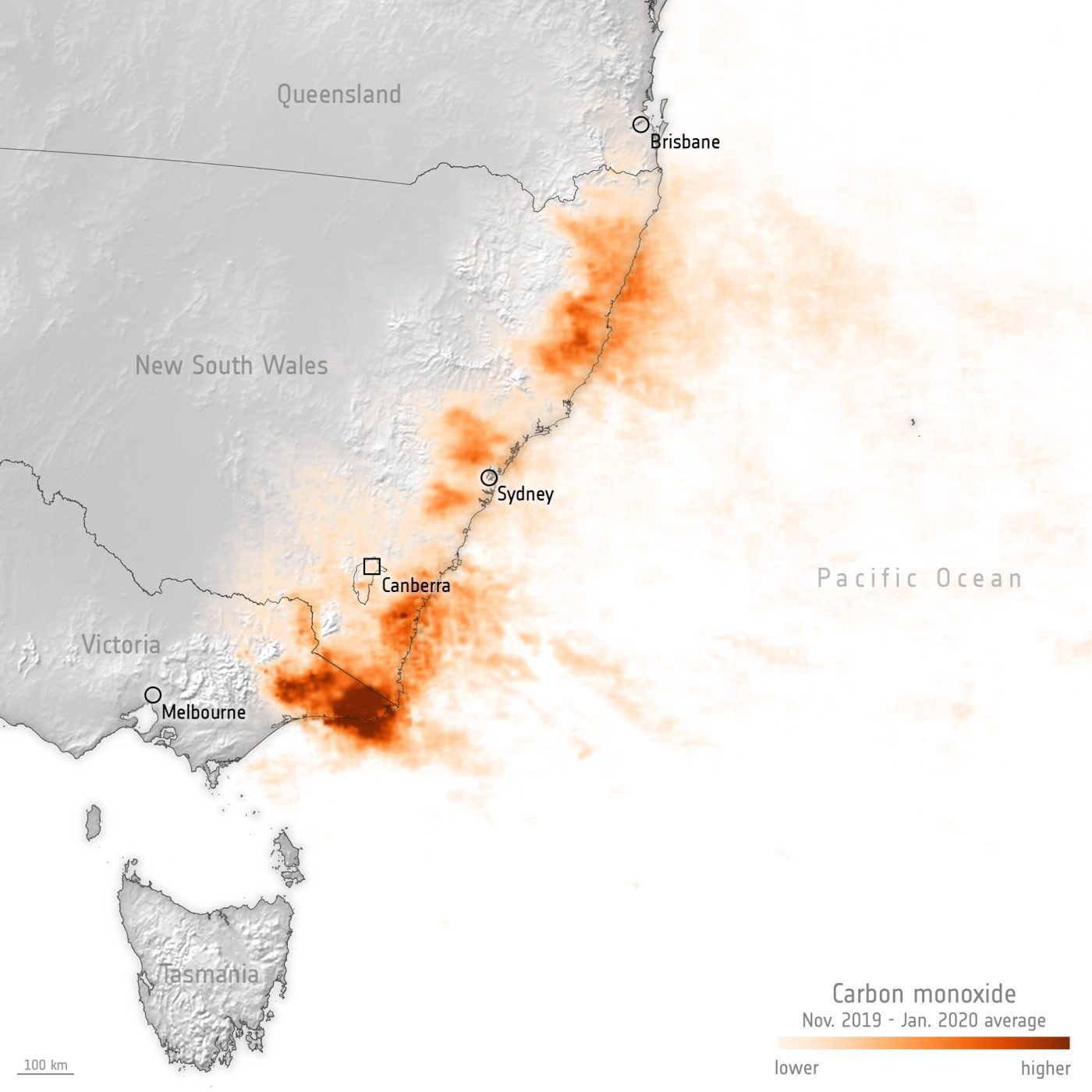
This image uses information from the Copernicus Sentinel-5P mission and shows the average carbon monoxide concentrations from Nov. 1, 2019, to Jan. 31, 2020. Carbon monoxide is commonly associated with traffic, but the concentrations here are due to the bushfires. Naturally, once in the air, it can cause problems for humans by reducing the amount of oxygen that can be transported in the bloodstream.

Image Credit: Contains modified Copernicus Sentinel data (2019-20), processed by ESA.