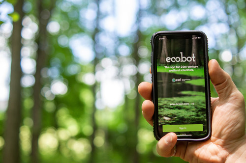
ASHEVILLE, N.C. – Ecobot, the transformative environmental data reporting platform, has been selected as one of 16 Esri partners to be featured on the ArcGIS Marketplace. ArcGIS, a geographic information system (GIS) application developed and maintained by industry leader Esri, has chosen “sustainability” as the overarching theme for the products that will be featured from July through September.

“On behalf of the Ecobot team, we are pleased with the opportunity to be featured on the ArcGIS Marketplace as they spotlight the importance of sustainability,” said Lee Lance, CEO of Ecobot. “With an increasingly heightened awareness of the impacts of climate change, accurate and efficient wetland mapping and data collection are more critical than ever in the construction planning and engineering process, and we’re thrilled to play a role in these efforts.”
The Ecobot app is the only natural resources consulting software to bring true efficiency and accuracy to wetland scientists in architectural, engineering and construction (AEC), as well as natural resources consulting firms, utility, oil, and gas companies and more. It is used by thousands of consultants to delineate wetlands for jurisdictional determination.
In 2020, Ecobot announced its partnership with Esri to integrate the company’s enhanced GIS mapping and data capabilities. The collaboration also enabled the addition of familiar geospatial modeling, mapping, georeferencing, and data collection capabilities within the app. These capabilities also further automated the process of wetland delineations, allowing Ecobot customers to support paperless mapping of wetlands by enabling scientists and engineers to walk the perimeter of a wetland, dropping virtual flags with a tap to the screen.
Ecobot is available for download on the Apple Store. To learn more, visit ecobotapp.com or the Esri ArcGIS Marketplace.
About Ecobot
Ecobot empowers the AEC and environmental consulting industry to better serve their clients by reducing the time and expenses required to complete environmental regulatory reporting, while providing certainty through more accurate reporting. Field scientists make critical decisions that inform land use and use Ecobot to submit thousands of wetland delineation reports to the USACE each month. See how Ecobot can transform your natural resources consulting workflow at ecobotapp.com.