
UgCS software now compatible with Parrot ANAFI drones to better serve professional users
Riga: SPH Engineering, the world’s premier UgCS software developer, announced today that the Parrot ANAFI UAV platform is now compatible with UgCS. ANAFI users now have access to the program’s vast range of tools to enhance professional drone operations and streamline land surveying and mapping processes.
The world’s premier UgCS (Universal ground Control Software) is a tool for enhanced UAV mission planning and data collection suitable for land surveying and industrial inspections. It is an industry-standard data acquisition instrument for professional drone pilots doing their job with a mixed multi-vendor drone fleet in large scale surveying projects. It allows to plan and fly drone survey missions to safely collect high-quality data, providing convenient technics for aerial and linear surveys and enabling direct drone control. UgCS also offers key features including custom elevation data import, terrain following mode and georeferenced video streaming.
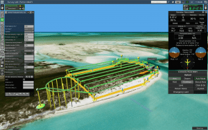
“UgCS is one of the most advanced mission planning software for drones. Its unique features make it the perfect tool to complete complex and large-scale mapping projects,” said Jerome Bouvard, Parrot Director of Strategic Partnership. “This partnership will broaden the mapping capabilities and software options available to professional ANAFI users as a whole.”
Through its SDK Partner program, Parrot is working to create a global ecosystem of drone software providers to serve the unique and ever-evolving needs of its enterprise and professional users.
“Parrot’s professional verticals include some of the most demanding users from public safety, construction, inspection, enterprise and government. To achieve their daily extensive and at times complex missions, they expect not only class-leading, proven secure drone technology that Parrot has the experience and is renowned for, but powerful software solutions that extend their advance usages and requirements,” said Chris Roberts, Parrot Vice President & Chief Sales & Marketing Officer. “When combining UgCS mission planning with the Parrot ANAFI drone platform this is achieved– enabling safe and efficient in-depth capabilities with powerful survey planning tools, custom elevation data import and terrain following.”
UgCS users’ global network unites private, public and educational organizations, as well as resellers in +150 countries since 2013. The software is regularly updated to support new drone types, while Parrot ANAFI support was added to new UgCS v.4.0. UgCS is offered as a monthly subscription or perpetual license, and new customers have the opportunity to take advantage of a 14-day free trial.
“SPH Engineering is excited to partner with Parrot in building the global drone ecosystem for consumers and professionals and support Parrot ANAFI in UgCS with safe and versatile UAV mission planning,” Alexei Yankelevich, R&D Director of SPH Engineering, comments. “This is a great line of drones with very competitive characteristics for construction, agriculture, S&R and other applications.”
For more information on Parrot and its ANAFI drones, visit Parrot.com. To learn more about UgCS software, visit ugcs.com.
Parrot: Airfoil for Parrot:
Cecilia Hage Elise Quintana
[email protected] [email protected]
Tel. +33 (1) 48 03 61 92 Tel. +1 248 304 1439
SPH Engineering:
Anastasiya Voronkova
About Parrot
Founded in 1994 by Henri Seydoux, Parrot is today the leading European group in the fast-growing industry of drones. Visionary, at the forefront of innovation, Parrot is the only group to be positioned across the entire value chain, from equipment to services and software.
The Parrot Group designs and engineers its products in Europe, mainly in France and Switzerland. It currently employs over 500 people worldwide and makes the majority of its sales outside of France. Parrot, headquartered in Paris, has been listed since 2006 on Euronext Paris (FR0004038263 – PARRO). Financial information can be found on http://corporate.parrot.com. For more information: www.parrot.com and its subsidiaries www.pix4d.com, www.sensefly.com, www.micasense.com.
About SPH Engineering / UgCS
SPH Engineering (sph-engineering.com) is the world’s premier UgCS (ugcs.com) software developer and integration services provider for unmanned aerial systems. Founded in 2013 in Latvia, the company has created a rich global customer network while over 45% of customers are located in North America. Its developed UgCS, UgCS CC, UgCS Mapper, ATLAS, Drone Show Software, and Industrial Integration Solutions for UAV with Echo Sounders, Ground Penetrating Radars (GPR), Magnetometers, Metal and Methane detectors, enriched with radar/laser altimeters, are applied across a wide range of industries worldwide.
