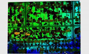
The new Galaxy CM2000’s small laser footprint allows for detection of fine corridor features
Vaughan, CANADA, August 4, 2020 ─ Teledyne Optech, a Teledyne Technologies [NYSE:TDY] company and global leader in advanced lidar sensors has extended its bestselling Galaxy lineup to include the CM2000 ,a new sensor specifically designed for corridor mapping.
With a true measuring rate of up to 2 million points per second, the Galaxy CM2000 delivers precise detail of fine corridor elements such as electric wires and conductors, distribution power poles, railway signs, cellular tower antennas, as well the ability to detect fine changes in the ground over time for pipeline monitoring.
The CM2000’s adjustable field of view, provides users with the flexibility to narrow the field of view to the exact width of their corridor and thus concentrate the laser measurements on their precise target. This combination of an adjustable field of view, and a measurement rate of 2 million points per second, will deliver data resolution that allows for advanced analytics, insights, and decision making.
The Galaxy CM2000 has the smallest laser footprint in the market allowing for complete detection of towers, transmission and distribution wires and attachment points on power poles. In addition, the CM2000 has built in roll compensation which corrects for turbulence on the aircraft, maintaining a constant swath width on the ground.
“The true advantage of the Galaxy CM2000 is its ability to improve the mapping of the infrastructures that we all rely on every day – including the electric grid we count on for power, or the roads and rail we depend on for safe travel. This is accomplished by providing an astounding level of detail via true 2 million points per second straight to the ground and a small laser footprint that allows for the modelling of complex targets like electric towers and distribution wires,” commented Malek Singer, Airborne Product Manager at Teledyne Optech.
The Galaxy CM2000 will be launched on August 12, 2020 with a live webinar event showcasing features and data acquired by the sensor in corridor mapping survey. Register for one of the available sessions:
August 12, 2020 at 9:00 a.m. EST
August 12, 2020 at 9:00 p.m. EST
About Teledyne Optech
Teledyne Optech is a part of the Teledyne Imaging Group and a world leader in high-accuracy lidar 3D survey systems, integrated cameras, and productivity-enhancing workflows. With operations and staff worldwide, Teledyne Optech offers both standalone and fully integrated lidar and camera solutions for airborne mapping, airborne lidar bathymetry, mobile mapping, terrestrial laser scanning, and mine cavity monitoring, as well as space-proven sensors. Teledyne Optech supports its clients with an around-the-clock team, on-site service, and regular efficiency enhancements to the workflow of its integrated systems.
Teledyne Imaging is a group of leading-edge companies aligned under the Teledyne umbrella. Teledyne Imaging forms an unrivalled collective of expertise across the spectrum with decades of experience. Individually, each company offers best-in-class solutions. Together, they combine and leverage each other’s strengths to provide the deepest, widest imaging and related technology portfolio in the world. From aerospace through industrial inspection, scientific research, spectroscopy, radiography and radiotherapy, geospatial surveying, and advanced MEMS and semiconductor solutions, Teledyne Imaging offers world-wide customer support and the technical expertise to handle the toughest tasks. Their tools, technologies, and vision solutions are built to deliver to their customers a unique and competitive advantage.
