
Graz, Austria- Vexcel Imaging is announcing the release of the next generation UltraCam Osprey 4.1, a highly versatile large-format aerial camera for the simultaneous collection of photogrammetric-grade nadir imagery (PAN, RGB and NIR) and oblique images (RGB). Frequent updates of sharp, noise-free and highly accurate digital representations of the world are essential for modern city planning. Enabling unprecedented flight collection efficiency at superior radiometric and geometric quality, the UltraCam Osprey 4.1 sets a new standard in urban mapping and 3D city modeling.
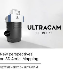
Leading up to the 4th generation of UltraCam aerial imaging sensors, the system combines new and industry-leading customized lenses, next generation CMOS imaging sensors with custom electronics, and a best-in-class image processing pipeline to deliver imagery of unprecedented quality, in terms of detail resolution, clarity and dynamic range. The system pushes flight productivity to new levels, collecting 1.1 Gigapixels every 0.7 seconds. Customers can fly faster, cover more area and see more detail.
The new and innovative Adaptive Motion Compensation (AMC) method compensates for multi-directional motion inducted image blur and compensates for ground sampling distance variations in oblique images in order to produce imagery of unprecedented vividness and sharpness.
Besides a new numbering format – the UltraCam Osprey 4.1 is a 4th generation camera in its first version – this new generation also introduces several design updates to increase the overall usability and user-friendliness. Amongst others: a reduced camera head extends aircraft options to even smaller planes and an optimized field of view enables easier installation without a camera lifter. Customers now have easier access to the IMU and UltraNav hardware in order to change UltraNav, or any other flight management system, on-site with no additional boresight required after IMU removal.
“With the UltraCam Osprey 4.1 you get two cameras in one housing. The system meets diverse application needs ranging from city mapping to traditional mapping applications from the same flight missions,” said Alexander Wiechert, CEO Vexcel Imaging. “At the same time, we have increased the nadir footprint significantly to over 20,000 pixels across the flight strip to create the flight collection efficiency typically gained only by large-format camera systems.”
Commercial availability of the UltraCam Osprey 4.1 is scheduled for early 2021.
Key Specifications
Vexcel Imaging, a leader in the geospatial industry, develops cutting-edge large-format aerial cameras, mobile mapping systems and photogrammetric software with innovative approaches, and places an emphasis on continuing product upgrades and world-class support. The broad UltraCam aerial camera portfolio covers all applications in airborne photogrammetry — from nadir to oblique to wide-area data collection. UltraCam data is processed with the UltraMap photogrammetry software, providing an end-to-end processing workflow for highly automated, quality data products that include point clouds, digital surface and terrain models, orthophotos and 3DTINs.
Learn more about Vexcel Imaging under www.vexcel-imaging.com
