
NEWTON, MA (USA) – Caliper Corporation is pleased to announce that Maptitude 2019, a major release of Caliper Corporation’s popular GIS (Geographic Information System) and mapping software, is available now. The 2019 version provides a robust new file structure that makes it simple to save and share maps in a single document. Maptitude 2019 also includes the most up-to-date and accurate data available.
Maptitude 2019 now includes one of the best features of Microsoft MapPoint, the ability to share and save your work using a single document! Maptitude 2019 can compress all of your windows, tables, and map layers into a single file for sharing. In addition, you can autosave and file lock your workspaces to protect your work and prevent accidental overwriting.
Support for discontinued Microsoft MapPoint and Streets & Trips files makes Maptitude the obvious replacement for those products. Maptitude 2019 imports waypoints directly into the Routing Manager, along with settings such as arrival and departure times, and supports MapPoint shapes/lines/text and the ability to edit them.
Maptitude 2019 also enhances your ability to update your map with changes made to your data source. In addition to updating geocoded point locations, you can update areas with changes in your Excel spreadsheet or SQL Server database.

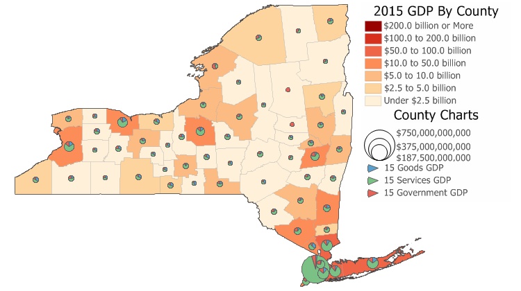
New U.S. data provide access to the most up-to-date geographic information available. Only Maptitude 2019 users will have access to completely new business-critical data. Now included are 18 new fields covering personal income, unique households, and GDP. We will also be updating our free premium data for Maptitude 2019 customers.
The boundaries (e.g., tracts, ZIP Codes, counties) have updated demographics and Census data such as buying power/disposable income, banking compliance data, and 2017 Census ACS data.
Maptitude 2019 also ships with the January 2019 ZIP Code boundaries, ensuring that you are using the latest nationwide postal data.
The 2019 U.S., Australia, Brazil, Canada, Mexico, New Zealand, and United Kingdom & Ireland country packages all include updated streets that allow for accurate address locating and street visualization, directions, drive-time rings, and drive-time territories.
You can create drive-time zone reports using the labels/names of your stores and customers. This allows you to create multiple travel rings around multiple locations and still be able to identify the location for each ring.
The Wizard driven interface walks you through adding shaded boundaries to an existing map, such as adding sales by ZIP Code to a customer map. Create-a-Map Wizard also automatically creates reports when demographics are chosen. All reports include the new data on income growth, population growth, and daytime population.
You can also create 3-D themes on two fields rather than just one; and can create travel time or distance tables between ZIP Codes or any other area layer.
