Thursday, March 15th, 2012
SimActive Inc., a world-leading developer of photogrammetry software, is pleased to announce release 4.0 of its Correlator3D product capable of producing dense digital surface models (DSM). Building on the success of its previous DSM module, this new release leaps ahead...
Thursday, February 23rd, 2012
The CropScape tool is designed to provide the public with easy access to interactive visualization, geospatial queries and dissemination without the need to download specialized software. Read More
Friday, February 17th, 2012
Z/I Imaging is pleased to announce the release of its Z/I Software version 6.4. Z/I Sensor Software includes a suite of products for the DMC and DMC II camera families for raw image data post processing, distributed...
Friday, December 16th, 2011
With Gatewing's Stretchout desktop software, we've challenged the accepted way of traditional photogrammetry by introducing highly advanced vision technology that changes the way you process your images. Stretchout runs fully automatic at the best possible performance and...
Thursday, December 8th, 2011
The uDig Community is pleased to announce the release of uDig 1.3.0. This release is made in conjunction with GeoTools 8.0-M4. Thanks to Andrea Amie and Gabriel Roldan for support, encouragement and timely bug fixes. This point release...
Friday, November 18th, 2011
In its efforts to promoting awareness on the use of Geographic Information System (GIS), this city’s local government together with the University of the Philippines Visayas Tacloban College-Regional Environmental Information System (UPVTC-REIS) last November 17 celebrated the...
Monday, October 17th, 2011
AViCAD not only provides you the best Plant Design CAD Solution but also offers you the best compatibility with AutoCAD. Our software always saves your drawing to the standard AutoCAD DWG format. This ensures unrivaled compatibility with AutoCAD without...
Thursday, July 14th, 2011
Software enabling video camera-equipped model helicopters to be controlled via WiMAX android tablet computers and cell phones during search and rescue missions was unveiled July 13 by Taipei-based Tatung University. “The remote-controlled helicopters can easily gain access to...
Friday, March 11th, 2011
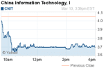
China Information Technology, Inc. (Nasdaq: CNIT) has reported a banner year with a 62% increase in revenue and a 39% increase in profit, largely led by an increase of 43% in its GIS segment. The company specializes...
Thursday, March 3rd, 2011
Bentley Systems, Incorporate today introduced, during its first Annual Corporate Update conference call, an innovative new “sustainable licensing” business model based on annual Portfolio Balancing. With this industry milestone, users no longer need to settle for software...
