Asian Surveying & Mapping
Breaking News
Australian Space Agency funds development of aerospace-grade GNSS receiver
The Australian Space Agency has funded the development of...
Continuity risks for Australian EO data access
A new report details the widespread use of Earth...
China launches new remote sensing satellite
JIUQUAN, April 15 (Xinhua) -- China on Monday launched...
7.4-Magnitude Earthquake Strikes Taiwan
A major, 7.4-magnitude earthquake struck the eastern coast of...
Tata Deploys Its Geospatial Satellite In Space on Space X’s Falcon 9 Rocket
THIRUVANANTHAPURAM: Tata Company launched India's first private commercial satellite...
Taiwan’s Formosat-8 Satellite Set for Launch by 2025
The Taiwan Space Agency has announced progress on the...
Iranian Scientists to Build Satellite Constellation for 2 Simultaneous Missions
The scientists at the knowledge-based company had previously succeeded...
China provides geospatial intel and other military support to Russia, US says
The US has warned its European allies that China...
Japanese lunar lander company ispace raises $53.5 million in stock sale
WASHINGTON — Japanese lunar lander developer has raised $53.5...
Esri and Prince Sultan University Advance GIS Education Through Strategic Partnership
Memorandum of Understanding with Institution Enhances GIS Curriculum and...

hong kong

Wednesday, February 1st, 2012

Geoinformatics 2012 – Hong Kong

The Geoinformatics conference series was initiated by the International Association of Chinese Professionals in Geographic Information Sciences(CPGIS) in 1992. This annual international conference has provided a unique forum for exchanging ideas and knowledge on geo-information sciences between...

Thursday, September 8th, 2011

Information Paper of the HK Digital Map

The Digital Maps covering the whole territory of Hong Kong are available for sale to the public from Map Publications Centre, Hong Kong. The Digital Maps are continuously updated by SMO. Except Digital Aerial Photos which are...

Monday, July 18th, 2011

Skies Set to Open for New HK Runway

Cities finally reach consensus on the opening up of airspace over the Pearl River Delta, boosting campaign for HK$136b Chek Lap Kok expansion. Read More

Thursday, June 30th, 2011

New HK Street Index & New Territories Lot/Address Table

The Land Registry has produced the 43rd edition of the Index of Streets, House Numbers and Lots in Hong Kong, Kowloon and New Kowloon (Street Index) and the 12th edition of the New Territories Lot/Address Cross Reference...

Wednesday, June 22nd, 2011

GeoMobile Map Hong Kong Launches

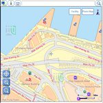
The Lands Department of Hong Kong launched a new mobile mapping application called "GeoMobile Map Hong Kong" this week, allowing users to view detailed government maps and to search for community facilities while on the move. This...

Monday, June 13th, 2011

Hong Kong Satellite Positioning Reference Station Network

Survey and Mapping Office (SMO) of Lands Department has applied new technology to improve the quality of services in recent years. It makes use of the Global Positioning System, GPS technology of United States to develop a...

Thursday, March 17th, 2011

Cadastre and Cadastral Survey History of Hong Kong

Hong Kong has a long history of mapping and surveying since the beginning of the colony. This history dates back as far as the Qin (221-206 B.C.) and Han (206 B.C. - 220 A.D.) dynasties. Initial land...

Monday, January 17th, 2011

Magnificent Rocks and Magic Scenery ─ Geo-tour Routes iPhone App

Hong Kong's interesting rock formations and natural landforms are numerous and easily accessible. The Agriculture, Fisheries and Conservation Department has launched its iPhone app to showcase various Geo-tour Routes in Hong Kong National Geopark. It's a free...

Saturday, June 16th, 2007

FIG Working Week 2007

The Fédération Internationale des Géometres (FIG) - the international federation of surveyors - held its annual Working Week, 14-18 May, in Hong Kong. The activities included the FIG General Assembly, held on 13 May. Forty five national...