Asian Surveying & Mapping
Breaking News
Australian Space Agency funds development of aerospace-grade GNSS receiver
The Australian Space Agency has funded the development of...
Continuity risks for Australian EO data access
A new report details the widespread use of Earth...
China launches new remote sensing satellite
JIUQUAN, April 15 (Xinhua) -- China on Monday launched...
7.4-Magnitude Earthquake Strikes Taiwan
A major, 7.4-magnitude earthquake struck the eastern coast of...
Tata Deploys Its Geospatial Satellite In Space on Space X’s Falcon 9 Rocket
THIRUVANANTHAPURAM: Tata Company launched India's first private commercial satellite...
Taiwan’s Formosat-8 Satellite Set for Launch by 2025
The Taiwan Space Agency has announced progress on the...
Iranian Scientists to Build Satellite Constellation for 2 Simultaneous Missions
The scientists at the knowledge-based company had previously succeeded...
China provides geospatial intel and other military support to Russia, US says
The US has warned its European allies that China...
Japanese lunar lander company ispace raises $53.5 million in stock sale
WASHINGTON — Japanese lunar lander developer has raised $53.5...
Esri and Prince Sultan University Advance GIS Education Through Strategic Partnership
Memorandum of Understanding with Institution Enhances GIS Curriculum and...

pix4d

Friday, June 23rd, 2017

Pix4D and Parrot Back 6 Top Researchers to Help them Answer key #ClimateChange Questions Using Drone Mapping

In December 2016, Pix4D and Parrot announced we would award a climate innovation grant to help foster innovation around the impact of global climate change.  We received over 250 proposals from researchers across a range of disciplines....

Tuesday, June 6th, 2017

Pix4D Expands R&D in Berlin

Drone-mapping software developer Pix4D announces the opening of a research and development office in Berlin, Germany. Pix4D products rely on advanced principles of photogrammetry, computer vision, and machine learning.  “By opening this office, we’re showing in a...

Tuesday, April 18th, 2017

Vertical Images: From Film Making to Inspection, and Why the Future of Drones Doesn’t Lie in Flying

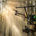
Successful drone entrepreneur Petr Lněnička went from award-winning filmmaker to drone inspection leader in his native Czech Republic. Here he lays out 3 pieces of advice and explains why for him, the transition seemed logical, and why...

Tuesday, March 7th, 2017

Pix4D Launches World’s First Crane Camera Solution for 3D Mapping and BIM at CONEXPO-CON/AGG 2017. Now in Store

Lausanne (Switzerland), March 7, 2017 - Pix4D, a Swiss developer of drone mapping software, and Liebherr, one of the world’s largest manufacturer of tower cranes, are launching a unique crane-based mapping solution at CONEXPO-CON/AGG in Las Vegas....

Wednesday, January 25th, 2017

Pix4D speaks at UN Panel on Food Security

Today the United Nations Commission on Science and Technology for Development ( CSTD) will hold an expert panel meeting on the role of science, technology, and innovation in ensuring food security by 2030. Pix4D’s agricultural business manager...

Wednesday, October 12th, 2016

Pix4D Launches MOBILE + DESKTOP + CLOUD Solutions for Drone Mapping at InterGeo 2016

Drone mapping software developer Pix4D launches hybrid solutions today that integrate mobile, desktop, and cloud platforms for more flexible mapping.   “When we started Pix4D six years ago, we were a cloud processing company,” said Christoph Strecha,...