Asian Surveying & Mapping
Breaking News
Australian Space Agency funds development of aerospace-grade GNSS receiver
The Australian Space Agency has funded the development of...
Continuity risks for Australian EO data access
A new report details the widespread use of Earth...
China launches new remote sensing satellite
JIUQUAN, April 15 (Xinhua) -- China on Monday launched...
7.4-Magnitude Earthquake Strikes Taiwan
A major, 7.4-magnitude earthquake struck the eastern coast of...
Tata Deploys Its Geospatial Satellite In Space on Space X’s Falcon 9 Rocket
THIRUVANANTHAPURAM: Tata Company launched India's first private commercial satellite...
Taiwan’s Formosat-8 Satellite Set for Launch by 2025
The Taiwan Space Agency has announced progress on the...
Iranian Scientists to Build Satellite Constellation for 2 Simultaneous Missions
The scientists at the knowledge-based company had previously succeeded...
China provides geospatial intel and other military support to Russia, US says
The US has warned its European allies that China...
Japanese lunar lander company ispace raises $53.5 million in stock sale
WASHINGTON — Japanese lunar lander developer has raised $53.5...
Esri and Prince Sultan University Advance GIS Education Through Strategic Partnership
Memorandum of Understanding with Institution Enhances GIS Curriculum and...

ERDAS

Tuesday, August 23rd, 2011

Intergraph and ERDAS Announce Product Synergies Webinar Series

Intergraph and ERDAS announce the Synergy Series, a set of webinars that showcases collaborative innovation. During the webinars, Intergraph and ERDAS will highlight workflows employing the technological strengths of the combined portfolios and provide a forum to...

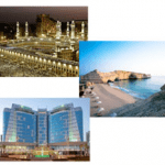
Thursday, March 3rd, 2011

11 World Tour Appearing in Middle East

ERDAS will team with GeoSystems Group for Information Technology in Saudi Arabia to host a series of 11 World Tour events in the Middle East. The first event will be held in Riyadh, Saudi Arabia...

Monday, December 20th, 2010

ERDAS 2011 Software – Available Now

ERDAS proudly announces the official release of ERDAS 2011 Software, including ERDAS IMAGINE, LPS, ERDAS APOLLO, ERDAS Extensions for ArcGIS 10 and other leading desktop and server products. Portfolio-wide changes for the ERDAS 2011 Software Release include the ability to...

Thursday, May 20th, 2010

ERDAS Focuses on Cutting through the Data Deluge

ERDAS has recently released ERDAS Software 2010, Version 10.1, which traces an imagery and geospatial data manipulation workflow from the raw image to the Internet. V1 editor Matt Ball spoke with Joel Campbell, who became president...

Thursday, July 16th, 2009

ERDAS APOLLO Supports Microsoft SQL Server

ERDAS has over 30 years of imagery expertise on both the desktop and server environments, and ERDAS APOLLO is the best solution in the market for managing and delivering imagery.  On top of handling extensive volumes of...