Asian Surveying & Mapping
Breaking News
Australian Space Agency funds development of aerospace-grade GNSS receiver
The Australian Space Agency has funded the development of...
Continuity risks for Australian EO data access
A new report details the widespread use of Earth...
China launches new remote sensing satellite
JIUQUAN, April 15 (Xinhua) -- China on Monday launched...
7.4-Magnitude Earthquake Strikes Taiwan
A major, 7.4-magnitude earthquake struck the eastern coast of...
Tata Deploys Its Geospatial Satellite In Space on Space X’s Falcon 9 Rocket
THIRUVANANTHAPURAM: Tata Company launched India's first private commercial satellite...
Taiwan’s Formosat-8 Satellite Set for Launch by 2025
The Taiwan Space Agency has announced progress on the...
Iranian Scientists to Build Satellite Constellation for 2 Simultaneous Missions
The scientists at the knowledge-based company had previously succeeded...
China provides geospatial intel and other military support to Russia, US says
The US has warned its European allies that China...
Japanese lunar lander company ispace raises $53.5 million in stock sale
WASHINGTON — Japanese lunar lander developer has raised $53.5...
Esri and Prince Sultan University Advance GIS Education Through Strategic Partnership
Memorandum of Understanding with Institution Enhances GIS Curriculum and...

China

Tuesday, September 20th, 2011

TP-TELTECH Selects ZWCAD for Network and ICT Infrastructure Design

ZWSOFT, a leading supplier of 2D and 3D CAD/CAM solutions to the AEC and MCAD industries, today announced that TP-TELTECH Sp. z o.o., a provider of network infrastructure services in Poland, selected ZWCAD for the design of...

Friday, September 16th, 2011

IBM’s Chinese Lab Takes on Internet of Things

The Internet of Things holds great promise with more objects and systems interconnected and available for query and data collection through Internet connectivity. IBM is leading the way with much of this development in a smarter city...

Wednesday, September 14th, 2011

China Accelerates Seabed Mapping Project

China will accelerate its pace of mapping the deep seabed, Zhang Jixian, president of the Chinese Academy of Surveying and Mapping, told China Daily. Unlike the electronic navigation chart released by the Chinese navy on Aug 25...

Monday, September 5th, 2011

Construction of Digital Cities Class – Chengdu Wenjiang

In accordance with the unified arrangements of the CPC Central Committee Organization Department, the State Bureau of Surveying and Mapping Geographic Information hosts digital city construction special class 2 to 7 September in Chengdu, Sichuan Wenjiang held. State...

Monday, September 5th, 2011

Mapping China’s New Development

Jin-Sheng Ning, an academician of the China Academy of Engineering and president of Wuhan University of Surveying and Mapping Institute and Li Jiancheng, Xu Yaming Vice President, Director of Surveying Engineering Institute Zou Jingui recently completed a visit...

Monday, August 29th, 2011

China’s First Official Electronic Chart In Service

Ships sailing in Chinese waters can now say goodbye to paper charts as anelectronic chart was officially released by the navy. The navigation guarantee department of the Chinese Navy Headquarters, China's officialhydrographic surveying and mapping organization, announced during a news briefing in Beijingthat China's new electronic navigation chart is available for purchase and download byregistered Internet users. The electronic navigation chart includes 400 maps of Chinese seas in different regions, anofficer surnamed Yuan from the navigation guarantee department, told China Daily. Read More

Thursday, August 25th, 2011

China Completes 1:50,000 National Map Database

China announced on Thursday that its mapping scientists have finished a 1:50,000-scale map database for comprehensive geographic information. The database will provide essential geographic reference to China's economic and social development, said an official with National Administration of...
Wednesday, August 24th, 2011

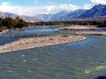
Finding the Source: Brahmaputra, Indus, Salween and Irrawaddy Rivers

The source of the Brahmaputra, Indus, Salween and Irrawaddy rivers was reported this week from scientists at the Chinese Academy of Sciences (CAS). Using satellite imagery, Liu Shaochuang, a researcher with the Institute of Remote Sensing Applications at CAS reported...

Tuesday, August 16th, 2011

Timber Trade Flow Maps of China and the Mekong Region

This report gives an interesting overview of the timber trade flows in Cambodia, China, Laos, Myanmar, Thailand, Vietnam and their respective trading partners. More than 20 maps graphically depict the import and export volumes and values of the wood...

Tuesday, July 12th, 2011

Offshore Surveying and Remote Sensing in China to Check Oilfields

The State Oceanic Administration (SOA) on Tuesday urged extensive checks to be conducted throughout all offshore oil-and gas-fields following the oil leak in a Bohai Bay oilfield under operation of a subsidiary of a U.S.-based energy company. Liu...

Page 5 of 8 1 2 3 4 5 6 7 8