Asian Surveying & Mapping
Breaking News
Australian Space Agency funds development of aerospace-grade GNSS receiver
The Australian Space Agency has funded the development of...
Continuity risks for Australian EO data access
A new report details the widespread use of Earth...
China launches new remote sensing satellite
JIUQUAN, April 15 (Xinhua) -- China on Monday launched...
7.4-Magnitude Earthquake Strikes Taiwan
A major, 7.4-magnitude earthquake struck the eastern coast of...
Tata Deploys Its Geospatial Satellite In Space on Space X’s Falcon 9 Rocket
THIRUVANANTHAPURAM: Tata Company launched India's first private commercial satellite...
Taiwan’s Formosat-8 Satellite Set for Launch by 2025
The Taiwan Space Agency has announced progress on the...
Iranian Scientists to Build Satellite Constellation for 2 Simultaneous Missions
The scientists at the knowledge-based company had previously succeeded...
China provides geospatial intel and other military support to Russia, US says
The US has warned its European allies that China...
Japanese lunar lander company ispace raises $53.5 million in stock sale
WASHINGTON — Japanese lunar lander developer has raised $53.5...
Esri and Prince Sultan University Advance GIS Education Through Strategic Partnership
Memorandum of Understanding with Institution Enhances GIS Curriculum and...

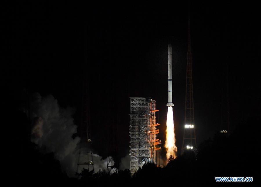
On June 5, 2018, China launched Fengyun-2H, a meteorological satellite that will be placed in a geosynchronous orbit. The launch took place using the three-stage rocket Long March 3A from Xichang Satellite Launch Centre in Sichuan Province.

Fengyun-2H, with a launch mass of 1,380 kilograms and a design life of four years, will be operated by the China Meteorological Administration (CMA) and the National Remote Sensing Center of China (NRSCC). The satellite will bolster China’s weather monitoring system within its territory, the South China Sea and the Indian Ocean. According to China, the satellite will be used by Belt and Road Countries as well as the Asia-Pacific Space Cooperation Organization (APSCO), an intergovernmental initiative led by Beijing.

Fengyun-2H will provide real-time cloud and water-vapor images, along with space weather information, to countries across Asia-Pacific (APAC), adding to the data collected by the eight other operational satellites in the Fengyun series.

Click here to read more.


(Image courtesy of CAS)