An extensive study presented in Nature Communications mapped the effects of small farmers on the rainforests of Southeast Asia, and findings are discouraging with regard to environmental impact, biodiversity and the economy.
Similar studies focused on large-scale palm oil producers and how they exploit the forest and soil. But Yann Clough, a researcher at the Faculty of Science at Lund University, mapped the choice of trees and agricultural methods of small-scale Indonesian farmers. Together with more than 40 researchers from Germany, Indonesia, Switzerland and New Zealand, they assessed the biodiversity and ecosystem functions in natural forest, traditional agroforests and monocultures of palm oil and rubber trees; the data measured includes forest growth, soil fertility and carbon storage. Furthermore, the team interviewed 450 small-scale farmers to better understand why they chose to cultivate only oil palms or rubber trees and how this affects their economy.
“For the great majority of small farmers, chopping down diverse forests and investing in a single species of tree—monoculture—is the simplest and quickest path out of poverty. Productivity increases, the financial risk drops and income rises,” noted Clough.
However, short-term financial gain is the only benefit of monoculture, according to the study. Biodiversity declines dramatically, the forest loses significance as a carbon source, and the increased use of mineral fertilizers leads to additional leaching of nutrients such as nitrogen. Although the study focused on Indonesia, there are equivalent problems in many other parts of the world.
The study and its results contradict the traditional view that small-scale agriculture is environmentally friendly. Collectively, small farmers cultivate a larger part of Indonesia’s forests than that exploited by large landowners. When small farmers largely embrace monoculture as an agricultural system, they put a great deal of strain on the environment and biodiversity. Changing the agricultural methods of small farmers requires efforts from various sides and must comprise financial support for the farmers to change their way of producing, according to researchers.
“Since small farmers earn more with monoculture, sustainability aspects and the effects on nature currently are almost entirely unheeded,” added Clough. “Changing production methods of small farmers requires financial incentives along with political will; otherwise there is a risk that rich and productive agricultural land will have disappeared altogether in 20 years.”
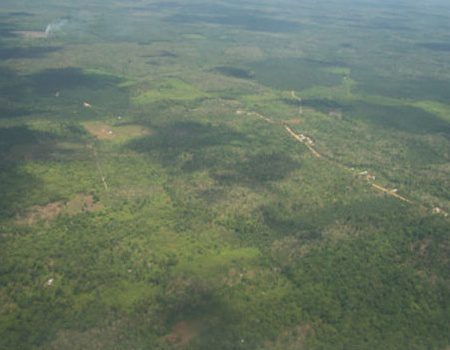
An aerial photo shows changes in land-use composition of the landscapes around the national park Bukit Duabelas and the Harapan Forest Restoration concession in Jambi Province, Indonesia, from 1990-2011, based on land-use classification inferred from remote sensing. (Credit: Heiko Faust


