Asian Surveying & Mapping
Breaking News
Australian Space Agency funds development of aerospace-grade GNSS receiver
The Australian Space Agency has funded the development of...
Continuity risks for Australian EO data access
A new report details the widespread use of Earth...
China launches new remote sensing satellite
JIUQUAN, April 15 (Xinhua) -- China on Monday launched...
7.4-Magnitude Earthquake Strikes Taiwan
A major, 7.4-magnitude earthquake struck the eastern coast of...
Tata Deploys Its Geospatial Satellite In Space on Space X’s Falcon 9 Rocket
THIRUVANANTHAPURAM: Tata Company launched India's first private commercial satellite...
Taiwan’s Formosat-8 Satellite Set for Launch by 2025
The Taiwan Space Agency has announced progress on the...
Iranian Scientists to Build Satellite Constellation for 2 Simultaneous Missions
The scientists at the knowledge-based company had previously succeeded...
China provides geospatial intel and other military support to Russia, US says
The US has warned its European allies that China...
Japanese lunar lander company ispace raises $53.5 million in stock sale
WASHINGTON — Japanese lunar lander developer has raised $53.5...
Esri and Prince Sultan University Advance GIS Education Through Strategic Partnership
Memorandum of Understanding with Institution Enhances GIS Curriculum and...
Imagery from Diwata-1 are expected to make it easier to identify areas affected by disasters such as floods and fires.

Imagery from Diwata-1 are expected to make it easier to identify areas affected by disasters such as floods and fires.

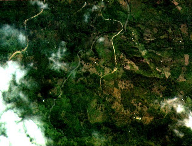
Diwata-1, the Philippines’ first microsatellite, collected and returned test images of some portions of Dumingag town in Zamboanga del Sur, a mountainous area in Mindanao, according to an attached agency of the country’s Department of Science and Technology. The images were taken by the high-precision telescope (HPT), one of four cameras onboard Diwata-1.

The Advanced Science and Technology Institute (ASTI) and the University of the Philippines Diliman noted that the images have a ground resolution of three meters at nadir (lowest point), which is the highest resolution attained by a microsatellite in the 50-kilogram class.

ASTI and UPD are coordinating with Japan’s Hokkaido and Tohoku Universities, which currently handle Diwata-1’s operation.

Click here for more information.